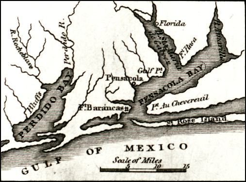
Description: Digitization provided by the USF Libraries Digitization Center. Rare Maps. This map of Florida was originally published in William Darby's Memoir on the geography and natural and civil history of Florida. This detail shows Pensacola Bay, Pensacola, and Fort Barancas and Fort Rosa. Prime meridians: Washington and London.
Place Names: Escambia, Escambia, Pensacola, Gulf of Mexico, Pensacola Bay, Perdido Bay, Fort Barancas, Santa Rosa Island, Fort Rosa
ISO Topic Categories: inlandWaters, oceans, boundaries, transportation
Keywords: Detail - Florida, physical, historical, political, transportation, physical features, country borders, county borders, railroads, inlandWaters, oceans, boundaries, transportation, Unknown,1834
Source: William Darby, Memoir on the geography and natural and civil history of Florida (Philadelphia, PA: Thomas H. Palmer, 1834)
Map Credit: Courtesy of the Special Collections Department, University of South Florida. |
|