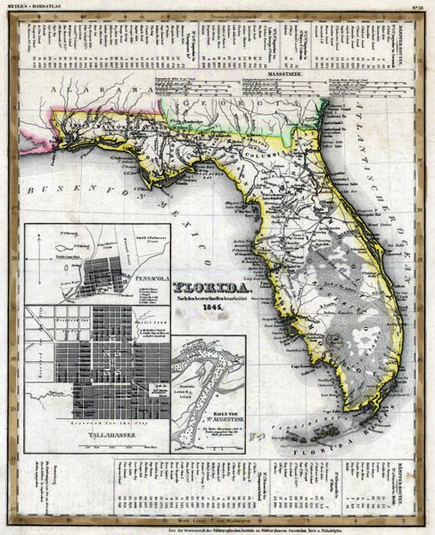
Description: Meyer's 1845 map of Florida is derived from the Tanner/Mitchell Universal atlas map of 1839, complete with the detail maps of Pensacola, Tallahassee, and Saint Augustine, and the water routes noted in the upper and lower margins. Certain discrepancies include the location of Lake Macaco, or Lake Okeechobee far to the west of its true position, and references to the Seminole War battle sites. Meyer's map does reference boundaries of Native American lands and routes across the peninsula used by the Indians.
Place Names: 1840-1859, Saint Augustine, Pensacola, Jacksonville, Pine Islands, Pine Keys, Thompson's Island, Key West, Tallahassee, Charlotte Harbor, Cape Canaveral
ISO Topic Categories: boundaries, inlandWaters, oceans, society, transportation
Keywords: Florida, physical, political, transportation, historical, physical features, major political subdivisions, roads, boundaries, inlandWaters, oceans, society, transportation, Unknown,1845
Source: Joseph Meyer, Grosser Hand-Atlas uber alle Theile der Erde (Hillsburghaus, : Hildburghausen: Bibliographischen Instituts, 1845) 148
Map Credit: Courtesy the private collection of Roy Winkelman |
|