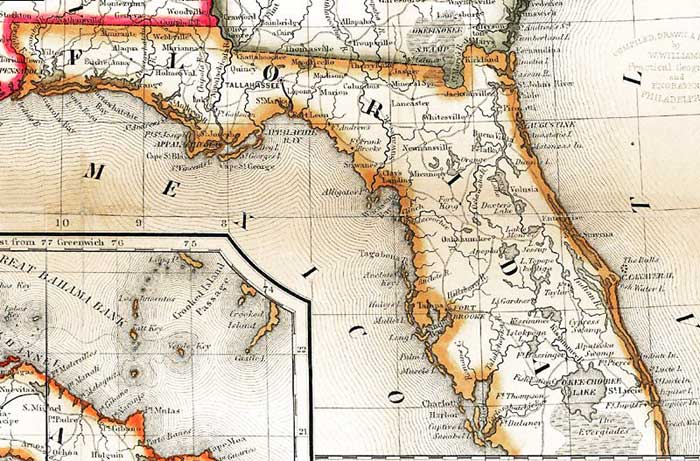
Description: A detail from the 1851 Williams map "A new map of the United States. Upon which are delineated its vast works of internal communication, routes across the continent &c. showing also Canada and the Island of Cuba," sowing Florida. Coastline, major rivers, lakes, and towns are shown, as well as roads and railroad routes.
Place Names: 1840-1859, Jacksonville, Cape Canaveral, Charlotte Harbor, Lake Okeechobee, Pensacola, Saint Augustine, St. Marks, Tallahassee, Tampa
ISO Topic Categories: boundaries, inlandWaters, oceans, transportation
Keywords: Detail - A new map of the United States, physical, political, transportation, historical, physical features, major political subdivisions, roads, railroads, boundaries, inlandWaters, oceans, transportation, Unknown,1851
Source: Wellington Williams, (Philadelphia, PA: Lippincott, Grambo & Co., 1851)
Map Credit: Courtesy of the Geography and Map Division of the Library of Congress |
|