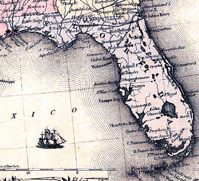
Description: This detail from the 1861 Colton map shows major rivers, cities, and railroads in Florida. The map also shows Army forts, including Fort McRae, Fort Pickens, and Fort Harrison. The full title of this map is "Colton's United States shewing the military stations, forts &c. Entered according to Act of Congress in the year 1855, by J.H. Colton. "
Place Names: 1860-1879, St. Johns River, Jacksonville, Saint Augustine, Cape Canaveral, Miami, Tampa, St. Marks, Tallahassee, Fort Pickens, Fort Harrison, Pensacola
ISO Topic Categories:
Keywords: Detail - Colton's United States shewing the military stations, forts &c, physical, political, transportation, historical, physical features, major political subdivisions, railroads, Civil War, Unknown,1861
Source: Joseph Hutchins Colton, (New York, NY: Lang & Laing , 1861)
Map Credit: |
|