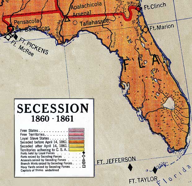
Description: A detail from the 1917 Albert Bushnell Hart series map showing Florida and its status as having seceded from the Union before April 14, 1861. The map shows forts, naval yards, and arsenals in Florida, and whether they were Union or Confederate held facilities. Fort Pickens near Pensacola, and forts Jefferson and Taylor in the Keys are shown as Union facilities, while forts Clinch, Marion, Barrancas, and McRee, the Pensacola Navy Yard, and the Apalachicola Arsenal are all shown as "seized by Seceding Forces."
Place Names: 1860-1879, Tallahassee, Ft. Clinch, Ft. Marion, Ft. Taylor, Ft. Jefferson, Apalachicola Arsenal, Pensacola, Ft. Barrancas, Ft. Pickens, Ft. McRee, Ft. McRea
ISO Topic Categories: boundaries, inlandWaters, society, oceans
Keywords: Detail - Secession, physical, political, historical, physical features, major political subdivisions, Civil War, boundaries, inlandWaters, society, oceans, Unknown,1860 to 1861
Source: R. Baxter Blair, Hart American history series (Chicago, IL: Denoyer-Geppert Co., 1917) A15
Map Credit: Courtesy of the Geography and Map Division of the Library of Congress |
|
