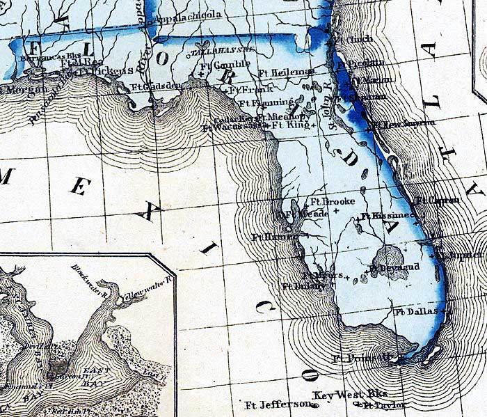
Description: This detail from the 1861 map "Military map of the United States & territories showing the location of the military posts, arsenals, Navy Yards, & ports of entry," primarily shows forts in Florida. Many of the forts are from the Seminole Wars era, while others were active during the Civil War.
Place Names: 1860-1879, Ft. Clinch, Ft. Picolata, Ft. Marion, Ft. Shannon, Ft. New Smyrna, Ft. Capron, Ft. Heileman, Ft. Frank, Ft. King, Ft. Brooke, Ft. Mead, Ft. Kissimee, Ft. Jupiter, Ft. Dallas, Ft. Myers, Ft. Poinsett, Ft. Taylor, Ft. Jefferson, Ft. Dulaney, Ft. Hamer, Ft. Wacussassa, Ft. Gainble, Ft. Gadsden, Ft. McRea, Ft. Pickens, Barrancas, Tallahassee
ISO Topic Categories: boundaries, inlandWaters, oceans, society
Keywords: Detail - Military map of the United States & territories..., physical, political, historical, physical features, major political subdivisions, other military, boundaries, inlandWaters, oceans, society, Unknown,1861
Source: Peter S. Duval and Son, (Philadelphia, PA: Peter S. Duval and Son, 1861)
Map Credit: Courtesy of the Geography and Map Division of the Library of Congress |
|