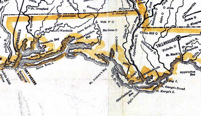
Description: Detail from the 1862 "Perrine's New military map illustrating the seat of war" showing the Florida panhandle from Pensacola Bay to Appalachee Bay. This detail primarily shows coastline and major rivers, Tallahassee and major towns. The railroads shown include the line between Pensacola and Montgomery, Alabama, Tallahassee and Lake City, St. Marks and Tallahassee, and St. Joseph and Iola.
Place Names: 1860-1879, Tallahassee, Pensacola, St. Marks, Ft. Pickens, Ft. McRea, St. Joseph, Iola, Apalachicola River
ISO Topic Categories: boundaries, inlandWaters, oceans, society, transportation
Keywords: Detail - Perrine's New military map illustrating the seat of war, physical, political, transportation, historical, physical features, major political subdivisions, railroads, Civil War, boundaries, inlandWaters, oceans, society, transportation, Unknown,1862
Source: Charles O. Perrine, (Indianapolis, IN: Charles O. Perrine, 1862)
Map Credit: Courtesy of the Geography and Map Division of the Library of Congress |
|