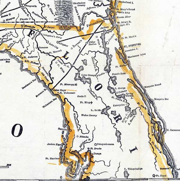
Description: Detail from the 1862 "Perrine's New military map illustrating the seat of war" showing the northern Florida peninsula from Amelia Island to Indian River on the Atlantic Coast and Apalachee Bay to Tampa Bay on the Gulf Coast. This detail primarily shows coastline and major rivers, Army forts and major towns. The railroads shown include the line between Tallahassee and Lake City, Jackson or Jacksonville and Alligator, and Fernandina and Cedar Keys.
Place Names: 1860-1879, Alligator, Tampa, Suwannee River, Cape Canaveral, Cedar Key, Fernandina, Anastasia Island, Jackson, Jacksonville, Amelia Island, Ft. Marion, Ft. King, Ft. Harrison, Ft. Hulbert, Ft. Micanopy, Ft. Capron, Ft. Floyd, Ft. Macomb, Ft. White, Ft. Brooke
ISO Topic Categories: boundaries, inlandWaters, oceans, society, transportation
Keywords: Detail - Perrine's New military map illustrating the seat of war, physical, political, transportation, historical, physical features, major political subdivisions, railroads, Civil War, boundaries, inlandWaters, oceans, society, transportation, Unknown,1862
Source: Charles O. Perrine, (Indianapolis, IN: Charles O. Perrine, 1862)
Map Credit: Courtesy of the Geography and Map Division of the Library of Congress |
|