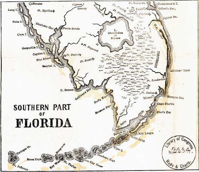
Description: Detail from the 1862 "Perrine's New military map illustrating the seat of war" showing the southern Florida peninsula. This detail primarily shows coastline, major rivers, major towns, and Army forts including forts Floyd, Swearingen, Jupiter, Lauderdale, Deynand, Keais, Dallas, Taylor, Jefferson, and Ft. Myakka.
Place Names: 1860-1879, Ft. Floyd, Ft. Swearingen, Ft. Jupiter, Ft. Lauderdale, Ft. Deynand, Ft. Keais, Ft. Dallas, Miami, Ft. Taylor, Ft. Jefferson, Ft. Myakka, Manatee, Key West, Charlotte Harbor
ISO Topic Categories: boundaries, inlandWaters, oceans, society, transportation
Keywords: Detail - Perrine's New military map illustrating the seat of war, physical, political, transportation, historical, physical features, major political subdivisions, railroads, Civil War, boundaries, inlandWaters, oceans, society, transportation, Unknown,1862
Source: Charles O. Perrine, (Indianapolis, IN: Charles O. Perrine, 1862)
Map Credit: Courtesy of the Geography and Map Division of the Library of Congress |
|