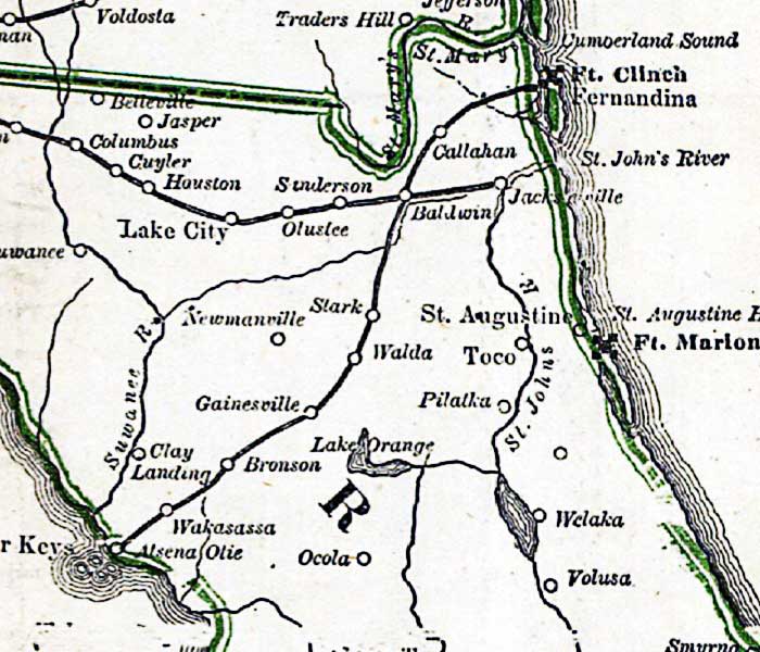
Description: This detail is from Russell's 1862 historical war map, showing the northern Florida peninsula, with Ft. Clinch and Ft. Marion on the Atlantic Coast. The railroad routes between Fernandina and Cedar Keys is shown, as well as the route from Jacksonville westward to Tallahassee.
Place Names: 1860-1879, Ft. Clinch, Fernandina, Saint Augustine, Ft. Marion, St. Johns River, Jacksonville, Cedar Keys, Gainesville, Ocola, Ocala, Lake City, Suwanee River, Suwannee River, Olustee
ISO Topic Categories: boundaries, inlandWaters, oceans, society, transportation
Keywords: Detail - The historical war map, physical, political, statistical, historical, transportation, physical features, major political subdivisions, population, railroads, Civil War, boundaries, inlandWaters, oceans, society, transportation, Unknown,1862
Source: Benjamin B. Russell, The historical war map (Buffalo, NY: Asher & Co. , 1862)
Map Credit: Courtesy of the Geography and Map Division of the Library of Congress |
|