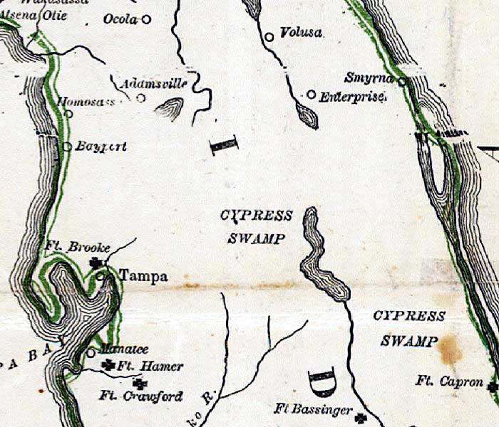
Description: This detail is from Russell's 1862 historical war map showing the central Florida peninsula, including Army forts Capron, Bassinger, Crawford, Hamer, and Ft. Brooke. Towns are also shown, including Volusa or Volusia, Smyrna, Manatee, Tampa, Bayport, and Ocola or Ocala.
Place Names: 1860-1879, Ocola, Ocala, Smyrna, Ft. Capron, Ft. Bassinger, Ft. Crawford, Ft. Hamer, Manatee, Tampa, Ft. Brooke, Bayport, Homosassa, Adamsville
ISO Topic Categories: inlandWaters, oceans, society
Keywords: Detail - The historical war map, physical, political, statistical, historical, physical features, major political subdivisions, population, Civil War, inlandWaters, oceans, society, Unknown,1862
Source: Benjamin B. Russell, The historical war map (Buffalo, NY: Asher & Co. , 1862)
Map Credit: Courtesy of the Geography and Map Division of the Library of Congress |
|