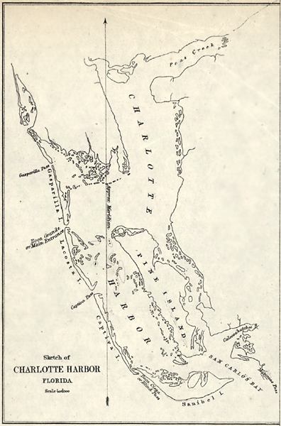
Description: This detail of a map of the main entrance to Charlotte Harbor showing the Charlotte Harbor area with surrounding islands, passes between islands, and bodies of water such as bays and rivers current to 1863. The map scale is 1:40,000. It includes the approximate meridian line.
Place Names: Charlotte, Charlotte Harbor, San Carlos, Peace River, Pine Island,
ISO Topic Categories: inlandWaters, oceans
Keywords: Detail - Preliminary chart of main entrance to Charlotte Harbor, physical, physical features, inlandWaters, oceans, Unknown,1863
Source: United States Coastal Survey, (Washington, DC: Government Printing Office, 1863)
Map Credit: Courtesy of the Geography and Map Division of the Library of Congress |
|