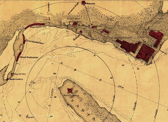
Description: This is a detail of a map that shows Florida current to 1850. The detail highlights Pensacola. There detail indicates fortifications, half-mile distance circles centered on Fort Pickens, beacons, roads and streets, vegetation, and a few soundings. There are also sand batteries which have been marked in red. The dashed lines in the Gulf indicate water depths.
Place Names: Escambia, Pensacola, Gulf of Mexico, Fort Pickens, Santa Rosa Island,
ISO Topic Categories: inlandWaters, oceans, transportation
Keywords: Detail - Sketch of Pensacola Navy Yard and Fort Dickens, physical, transportation, hydrological, physical features, roads, water depths, inlandWaters, oceans, transportation, Unknown,1860s
Source: W.A. Williams, (Boston, MA: L. Prang & Company, 1860)
Map Credit: Courtesy of the Geography and Map Division in the Library of Congress |
|