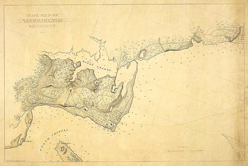
Description: This map is a topographical view of Warrington and its vicinity and was created between 1861 and 1865. Large bodies of water included on the map are Bayou Grande, Swash Channel, and the Gulf Of Mexico. Fort Pickens is noted on the map, as well as the Navy Yard on the mainland. A scale is given on the map.
Place Names: Escambia, Warrington, Swash Channel, Gulf of Mexico, Fort Pickens
ISO Topic Categories: inlandWaters, oceans, transportation
Keywords: Map of Warrington, physical, transportation, physical features, topographical, roads, inlandWaters, oceans, transportation, Unknown,1860s
Source: C. Spangenberg, (Washington, DC: United States War Department, 1865)
Map Credit: Courtesy of the National Archives and Records Administration |
|