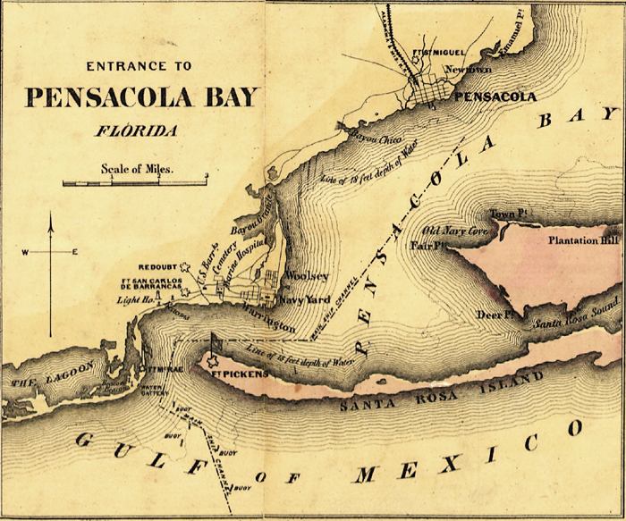
Description: This detail of a map is from Colton's plans of U. S. harbors showing the position & vicinities of the most important fortifications on the sea-board and in the interior From U. S. surveys and other authentic sources. This larger map is composed of twenty-three maps. This detail is a 13 x 16 cm section that shows Pensacola Bay, the Lagoon, and the Gulf of Mexico along with other waterways such as sounds, rivers, and bayous. There is moderate detail given to the Pensacola and Fort San Carlos de Barrancas areas.
Place Names: Escambia, Pensacola, Pensacola Bay, Gulf of Mexico, Plantation Hill, Santa Rosa Sound, Fort Pickens, Warrington, Woolsey,
ISO Topic Categories: inlandWaters, oceans, transportation
Keywords: Detail - Entrance to Pensacola Bay, physical, transportation, physical features, railroads, inlandWaters, oceans, transportation, Unknown,1862
Source: J.H. Colton, (New York, NY: Lang & Laing, 1862)
Map Credit: Courtesy of the Library of Congress, Geography and Map Division |
|