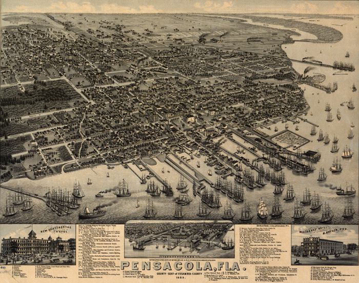
Description: This map is of a panoramic view of Pensacola, the county seat of Escambia County, current to 1885. The map shows details about streets, harbors, railroads, and ship yards. Labeled on the map are many local businesses, churches, the Courthouse, and post office. Dwellings and other buildings are shown. There are three close-up shots: the New Continental Hotel, the Navy Yards, and the Merchants' Hotel. The map is from a bird's-eye-view and is drawn to perspective rather than scale. The perspective is from west to east.
Place Names: Escambia, Pensacola
ISO Topic Categories: inlandWaters, oceans, transportation
Keywords: Pensacola Florida, physical, transportation, physical features, roads, railroads, inlandWaters, oceans, transportation, Unknown,1885
Source: Beck & Pauli, (Milwaukee, WI: Milwaulkee, Norris, Wellge, & Company, 1885)
Map Credit: Courtesy of the Geography and Map Division of the Library of Congress |
|