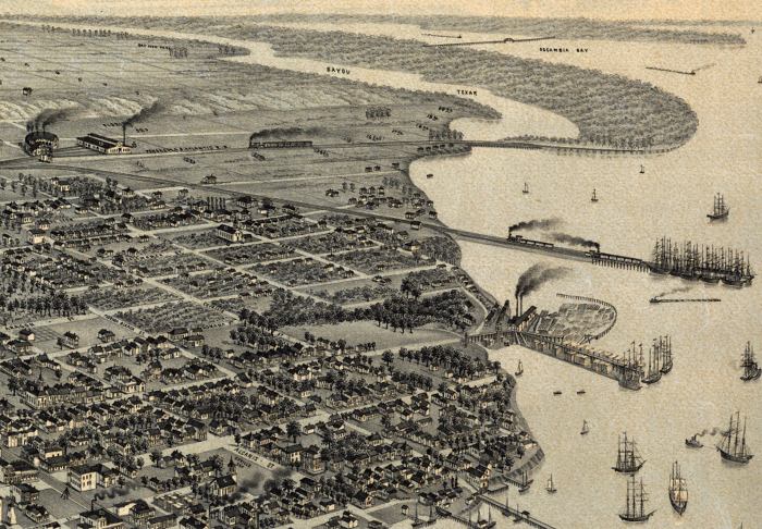
Description: This detail of a map is of a panoramic view of Pensacola, the county seat of Escambia County, current to 1885. The map shows details about streets, harbors, railroads, and ship yards. This map highlights Pensacola's relationship with Escambia Bay and Bayou Texar. Dwellings and other buildings are shown. The map is from a bird's-eye-view and is drawn to perspective rather than scale. The perspective is from west to east.
Place Names: Escambia, Pensacola, Escambia Bay, Bayou Texar,
ISO Topic Categories: inlandWaters, transportation
Keywords: Detail - Pensacola Florida, physical, transportation, physical features, roads, railroads, inlandWaters, transportation, Unknown,1885
Source: Beck & Pauli, (Milwaukee, WI: Milwaulkee, Norris, Wellge, & Company, 1885)
Map Credit: Courtesy of the Geography and Map Division of the Library of Congress |
|