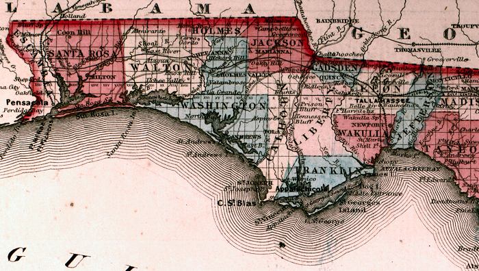
Description: This is a detail from Johnson's Florida map, circa 1860, showing the Florida panhandle. It shows counties of the period in color, towns, villages, county seats, forts such as Ft. Pickens, railroads, common roads, canals, state capital at Tallahassee, inland waters such as the Apalachicola River, and Section Township Range (STR). The railroad routes shown are between Pensacola and Montgomery, AL, St. Marks and Tallahassee, Quincy and Tallahassee, and the route between Tallahassee eastward to Jacksonville.
Place Names: 1860-1879, Tallahassee, Pensacola, Gulf of Mexico, Cape San Blas, St. Marks, Appalachicola, Quincy
ISO Topic Categories: boundaries, inlandWaters, oceans, transportation
Keywords: Detail - Johnson's Florida, physical, political, historical, transportation, physical features, county borders, railroads, roads, water routes, boundaries, inlandWaters, oceans, transportation, Unknown,1860
Source: Johnson, A.J., Johnson's New Illustrated Family Atlas (New York, NY: Johnson and Browning, 1860) 40
Map Credit: Courtesy the private collection of Roy Winkelman. |
|