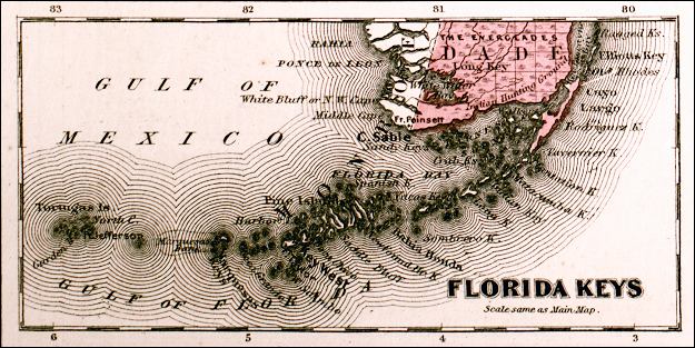
Description: This is a detail from Johnson's Florida map, circa 1860, showing the Florida Keys and the southern Florida peninsula. It shows counties of the period in color, towns, villages, county seats, forts such as Ft. Jefferson and Ft. Taylor, the Keys, and Section Township Range (STR) on the mainland. There are several references to Native American lands in this detail such as the Indian hunting grounds at the southern tip of the peninsula.
Place Names: 1860-1879, Gulf of Mexico, Gulf of Florida, Florida Bay, Ft. Taylor, Ft. Jefferson, Ft. Poinsett, Key West, Tortugas,
ISO Topic Categories: boundaries, inlandWaters, oceans
Keywords: Detail - Johnson's Florida, physical, political, historical, transportation, physical features, county borders, water routes, boundaries, inlandWaters, oceans, Unknown,1860
Source: Johnson, A.J., Johnson's New Illustrated Family Atlas (New York, NY: Johnson and Browning, 1860) 40
Map Credit: Courtesy the private collection of Roy Winkelman. |
|