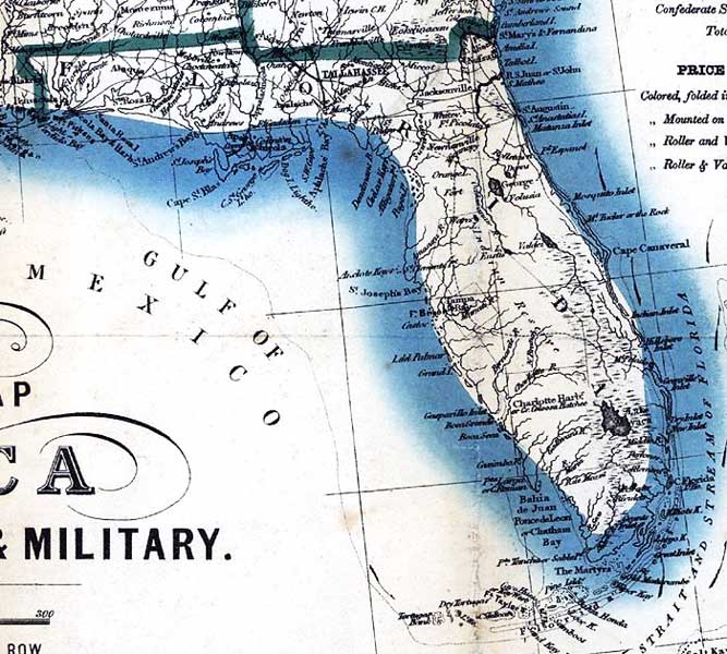
Description: This detail from Bacon's hand colored 1863 map shows Florida as a Confederate state, including major military installations, cities, railroads, roads, and Indian lands.
Place Names: 1860-1879, Ft. Clinch, Fernandina, Saint Augustine, Cape Canaveral, Jacksonville, Ft. Picolata, Tallahassee, St. Marks, Pensacola, Ft. Pickens, Ft. McRae, Tampa, Ft. Brooke, Charlotte Harbor, Lake Mayaca, Lake Okeechobee, Key West, Ft. Taylor, Dry Tortugas
ISO Topic Categories: boundaries, inlandWaters, oceans, society, transportation
Keywords: Detail - Bacon's steel plate map of America, political, historical & military, physical, political, transportation, historical, physical features, major political subdivisions, roads, Civil War, boundaries, inlandWaters, oceans, society, transportation, Unknown,1863
Source: , (London, : Bacon & Co, 1863)
Map Credit: Courtesy of the Geography and Map Division of the Library of Congress |
|