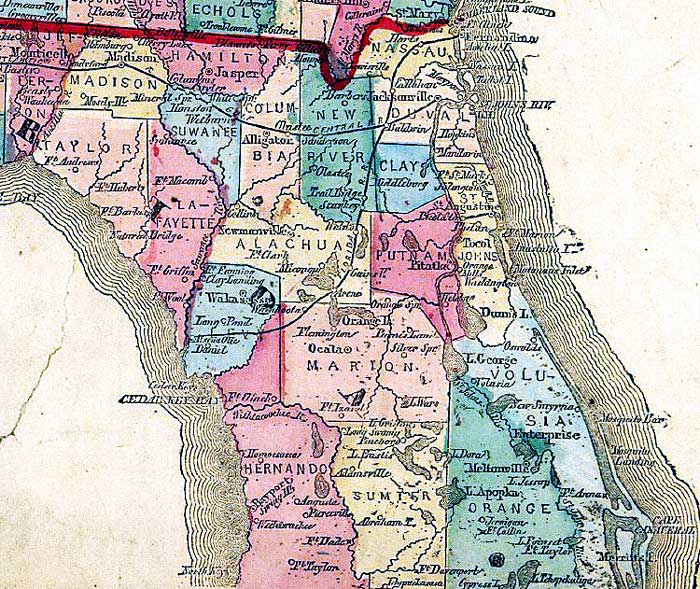
Description: This detail from the 1863 Lloyd's new county map of the United States shows the northern Florida peninsula. The map shows counties of the period, Army forts and battle sites, and railroad routes from Jacksonville westward to Tallahassee, and from Fernandina to Cedar Keys.
Place Names: 1860-1879, Fernandina, St. Johns River, Saint Augustine, Cape Canaveral, Newmanville, Newnansville, Ocala, Jacksonville, Alligator
ISO Topic Categories: boundaries, inlandWaters, oceans, society, transportation
Keywords: Detail - Lloyd's new county map of the United States and Canadas..., physical, political, transportation, historical, physical features, major political subdivisions, county borders, railroads, Civil War, boundaries, inlandWaters, oceans, society, transportation, Unknown,1863
Source: , (New York, NY : Schönberg & Co. , 1863)
Map Credit: Courtesy of the Geography and Map Division of the Library of Congress |
|