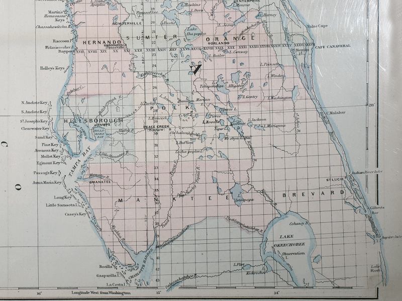
Description: This detail of Asher and Adams' 1871 map of Florida shows county lines and county seats current to the period, major towns and cities in the central Florida peninsula. The Township and Range survey grid is shown extending from the Tallahassee Base Line and the Tallahassee Meridian (established in 1824). Two city names have subtitles: Brooksville or Pierceville in Hernando County and Peace Creek or Bartow in Polk County. Digitization provided by the USF Libraries Digitization Center
Place Names: 1860-1879, Cape Canaveral, Charlotte Harbor, Bayport, Tampa, Orlando, Manatee, Lake Okeechobee, St. Lucie, Peace Creek, Bartow, Brooksville, Pierceville, Sumterville,
ISO Topic Categories: boundaries, inlandWaters, oceans, transportation
Keywords: Detail - Asher & Adams’ Florida, physical, political, physical features, major political subdivisions, county borders, boundaries, inlandWaters, oceans, transportation, Unknown,1871
Source: Asher & Adams, Asher & Adams’ new commercial, topographical, and statistical atlas and gazetteer of the United States (New York, NY: Asher & Adams, 1871)
Map Credit: Courtesy of the Special Collections Department, University of South Florida |
|