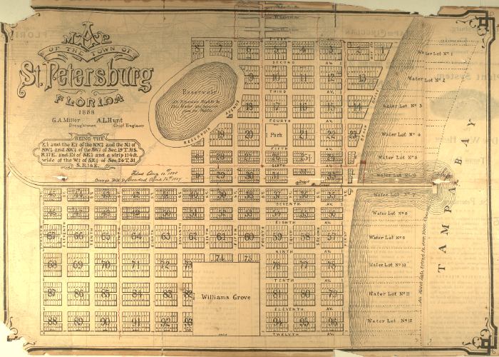
Description: This map shows the town of Saint Petersburg, Florida, current to 1888. Twelve water lots are portioned from bay-side beach that extend to deep water channel. Williams Grove is depicted at the south of the map. A reservoir is noted further north. Streets and lots are shown with numbers- each block being numbered counterclockwise.
Place Names: Pinellas, Saint Petersburg, Tampa Bay, Williams Grove,
ISO Topic Categories: inlandWaters, oceans
Keywords: Map of the Town of Saint Petersburg, physical, physical features, inlandWaters, oceans, Unknown,1888
Source: G. A. Miller and A.L. Hunt, (, : G. A. Miller and A.L. Hunt, 1888)
Map Credit: Courtesy of the Special Collections Department, University of South Florida |
|