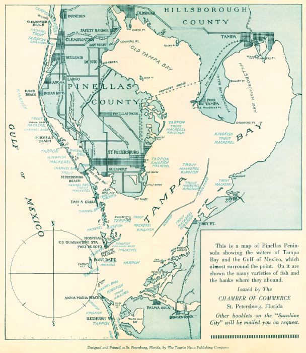
Description: This is a map of the Pinellas Peninsula showing the waters of Tampa Bay and the Gulf of Mexico, which almost surround the point. On it are shown many varieties of fish and the banks where they abound. This booklet map is current to the mid-1900s. Some of the varieties of fish are trout, mackerel, kingfish, tarpon, and channel bass. The major roads are shown as well as grids for the largest areas.
Place Names: Pinellas, Saint Petersburg, Tampa Bay, Hillsborough County, Pinellas County, Hillborough Bay, Gulf of Mexico, Gulfport, Clearwater, Tarpon Springs
ISO Topic Categories: inlandWaters, oceans
Keywords: Map of the Tampa Bay Fishing Sites, physical, physical features, inlandWaters, oceans, Unknown,mid 1900s
Source: The Tourism News Publishing Company, (Saint Petersburg, FL: The Tourism News Publishing Company, 1900)
Map Credit: Courtesy of the Special Collections Department, University of South Florida |
|