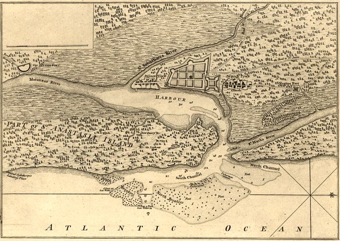
Description: This is a map of St. Augustine and its harbor, circa 1762. This map shows roads, water depths by soundings, locations, physical features and inland waters. The scale for the map is 1:47,000. The typed label on the map reads "William Roberts' An Account of the First Discovery and Natural History of Florida."
Place Names: St. Johns, Saint Augustine, St. Augustine, Atlantic Ocean, St. Marks River, Matanzas River, St. Sebastians River, Anastasia Island, Castillo de San Marcos, Indian Town,
ISO Topic Categories: inlandWaters, transportation, location
Keywords: Plan of the Town and Harbour of St. Augustine, historical, transportation, physical, hydrological, physical features, roads, water depths, inlandWaters, transportation, location, Unknown,1762
Source: William Roberts, (, : , 1762)
Map Credit: Courtesy of the Geography and Map Division of the Library of Congress |
|