Maps Site map
  FL Maps > Local > St. Johns
Site Map  

City and Local Maps for St. Johns County

Click on a thumbnail image to view a full size version of that map.


  Record   1   to   25  of   43

Map of Fort Matanzas, 1742
This map, adapted from a National Park Service map, shows the present day coastline around Matanzas Inlet and Anastasia Island and the coastline circa 1742. The map show the strategic location of Fort Matanzas at the mouth of the inlet, guarding the ...

St. Augustine Fort, 1756
Map of the fort at St. Augustine. Shows the areas of the fort, the moat, and the street leading to the fort. Shows all the rooms that were inside the fort and labels them....

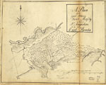
A plan of the land between Fort Mossy and St. Augustine, 1760s
This is a map of the plan of the land between Fort Mossy, or Fort Mose, and Saint Augustine in the province of East Florida. It shows "Spanish old fields overgrown with scrubs." The map shows marshes and the Saint Sebastian Creek. The map i...

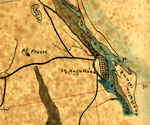
Detail - A plan of the land between Fort Mossy and St. Augustine, 1760s
This is a detail of a map of the plan of the land between Fort Mossy, or Fort Mose, and Saint Augustine in the province of East Florida. The deatil shows Mose Fort and Mose Creek. It shows "Spanish old fields overgrown with scrubs." The map...

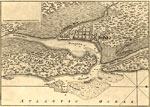
Plan of the Town and Harbour of St. Augustine, 1762
This is a map of St. Augustine and its harbor, circa 1762. This map shows roads, water depths by soundings, locations, physical features and inland waters. The scale for the map is 1:47,000. The typed label on the map reads "William Roberts' An ...

Detail - Plan of the Town and Harbour of St. Augustine, 1762
This is a detail of a map of St. Augustine and its harbor, circa 1762. This map shows roads, water depths by soundings, locations, physical features and inland waters. IT shows two Indian Towns in closer depth. The scale for the map is 1:47,000. The ...

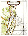
Plan Du Port De St. Augustin dans la Floride No. 39, 1764
Digitization provided by the USF Libraries Digitization Center. Rare Maps. This is a map of the plan of Saint Augustine and its port. Relief shown pictorially. Soundings shown in feet. Measurements.Dimensions: 21 x 16 cm. on sheet 33 x 26 cm. Measure...

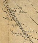
Detail - East and West Florida, 1774
This detail of Saint Augustine is from a map drawn in 1774, part of a two map set showing the northern portion of the Florida peninsula. It is primarily a navigational chart with rhumblines, soundings, and coastal features. The map includes sailing d...

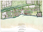
Plan of the Town of St. Augustine the capital of East Florida, 1777
Digitization provided by the USF Libraries Digitization Center. Rare Maps. This is a map of the plan of Saint Augustine, circa 1777. Oriented with north to the right. Relief shown pictorially. Streets and primary buildings of St. Augustine are shown....

Detail - Plan of the Town of St. Augustine the capital of East Florida, 1777
Digitization provided by the USF Libraries Digitization Center. Rare Maps. This is a detail of a map of the plan of Saint Augustine, circa 1777. It focuses on Saint Mark. Oriented with north to the right. Relief shown pictorially. Streets and primar...

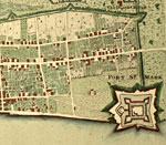
Detail - Plan of the Town of St. Augustine the capital of East Florida, 1777
Digitization provided by the USF Libraries Digitization Center. Rare Maps. This is a detail of a map of the plan of Saint Augustine, circa 1777. It focuses on the southern area of Saint Augustine. Oriented with north to the right. Relief shown picto...

Plan of the Town and Harbour of St. Augustin in East Florida, 1783
Digitization provided by the USF Libraries Digitization Center. Rare Maps. This is a map of St. Augustine and its harbor, circa 1783. This map shows roads, water depths, locations, physical features and inland waters. Also shown are forts, Indian tow...

Plano de la ciudad de San Agustin de la Florida, 1783
Digitization provided by the USF Libraries Digitization Center. Rare Maps. This is a hand colored map of the Saint Augustine region and its port (puerto), circa 1783. This map also shows Fuerte Negro (Fort Mose) which was the first legally sanctioned...

St. Augustine Engraved for Luffman's Select Plans, 1802
Digitization provided by the USF Libraries Digitization Center. Rare Maps. This is a map of St. Augustine which was the capital of East Florida, circa 1802. This map shows roads, Indian towns, the fort (San Marcos), inland waters and water depths. Th...

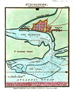
Saint Augustine, 1850
Digitization provided by the USF Libraries Digitization Center. Rare Maps. This is a map of St. Augustine and its harbor, circa 1850. This map shows water depths measured in fathoms, locations, physical features and inland waters. Also shown is the g...

Detail - Map of the cost [sic] of Georgia & Florida, 1863
This detail of a map of the coast of Georgia down to Florida between Savannnah and Saint Augustine current to 1863. The detail outlines Saint Augustine and the surrounding areas. It shows swamps, marshes, and railroads. Anastasia Island is on the sou...

St. Augustine, 1890
A map of the vicinity of St. Augustine, Florida showing rivers, streets, railroads, beaches, and lighthouses....

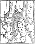
St. Augustine, 1890
A map of St. Augustine showing rivers, streets, railroads, and important landmarks. Includes Fort Marion, which is now known as the Castillo de San Marcos....

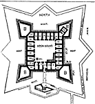
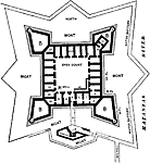
Plan of Fort Marion, 1890
This map shows the layout of Fort Marion, which is now known as the Castillo de San Marcos....

Map of St. Augustine, 1898
Map shows the layout of St. Augustine and surrounding area in 1898 C.E. Shows local roads leading to and from the city. Shows bodies of water that surround the fort and the city. Shows the fort and lighthouse. Reference Table that tells the major bui...

St. Augustine, 1909
Digitization provided by the USF Libraries Digitization Center. Rare Maps. This is a map of St. Augustine, circa 1909. This map shows city roads, railroads, bridges, locations of places (hospital, municipal building, etc.), Castillo de San Marcos whi...

Bakersville, 1936
This is a detailed map of the city Bakersville in St. Johns County, Florida. Section Township Range (STR) is shown. This map shows state roads, turpentine stills, a church, forest ranger lookout station, a cemetery, farm units and dwellings other tha...

Durbin, 1936
This is a detailed map of the city Durbin in St. Johns County, Florida. Section Township Range (STR) is shown. This map shows transportation routes such as state roads, US highways and railroads, also businesses, camp, sawmill, farm units and dwellin...

Elkton, 1936
This is a detailed map of the city Elkton in St. Johns County, Florida. Section Township Range (STR) is shown. This map shows state roads, railroads, bituminous roads, turpentine stills, churches, schools, a cemetery, farm units and dwellings other t...

Next Last


  FL Maps > Local > St. Johns
Site Map  

Maps ETC is a part of the Educational Technology Clearinghouse
Produced by the Florida Center for Instructional Technology © 2007
College of Education , University of South Florida