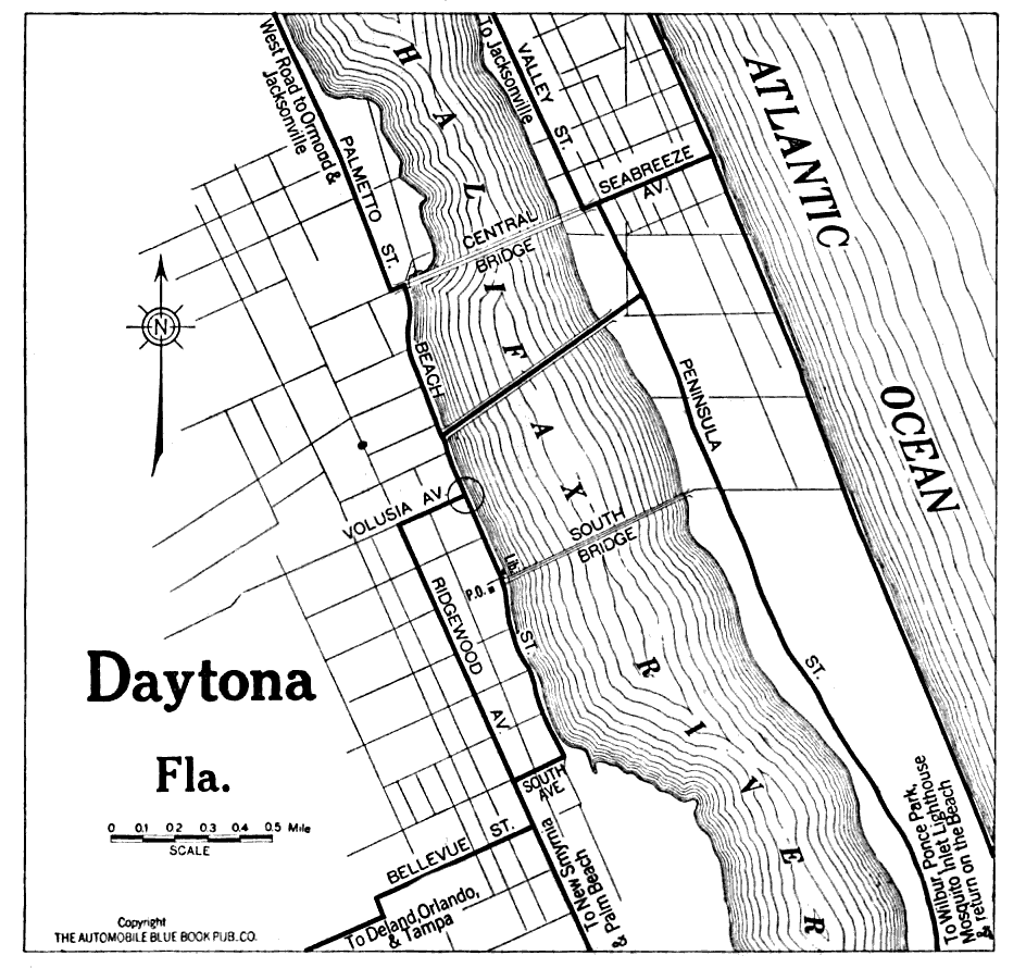
Description: Map of Daytona, Florida in 1919 C.E. Shows local roads around Daytona, Florida. Shows Atlantic Ocean and the Halifax River. The roads that lead in to the ma are from Wiilbur, Ponce Park, Deland, Orlando, Tampa, Ormond, and Jacksonville. The South and Central Bridges are featured.
Place Names: Volusia, Daytona Beach, Halifax River, Atlantic Ocean,
ISO Topic Categories: transportation, oceans, inlandWaters
Keywords: Daytona Florida, physical, transportation, roads, transportation, oceans, inlandWaters, Unknown,1919
Source: The Automobile Blue Book Corporation, Middle Atlantic and Southeastern Automobile Blue Book 1922 (New York, NY: The Automobile Blue Book Corporation, 1919)
Map Credit: Courtesy the private collection of Roy Winkelman |
|
