Maps Site map
  FL Maps > Local > Volusia
Site Map  

City and Local Maps for Volusia County

Click on a thumbnail image to view a full size version of that map.

  Record   1   to   25  of   25

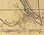
Detail - East and West Florida, 1774
This detail of Spruce Creek is from a map drawn in 1774, part of a two map set showing the northern portion of the Florida peninsula. It is primarily a navigational chart with rhumblines, soundings, and coastal features. The map includes sailing dire...

Bird's Eye View of De Land, Fla., 1884
This map is of a panoramic view of De Land, current to 1884. The map shows details about streets and various points of interest. This map highlights various churches, hotels, and small businesses. The map is from a bird's-eye-view and is drawn to per...

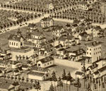
Detail - Bird's Eye View of De Land, Fla., 1884
This detail of a map is of a panoramic view of De Land, current to 1884. The map shows details about streets and various points of interest. This map highlights various churches, hotels, and small businesses. The detail shows a closer look at dwellin...

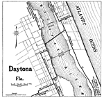
Daytona Florida, 1919
Map of Daytona, Florida in 1919 C.E. Shows local roads around Daytona, Florida. Shows Atlantic Ocean and the Halifax River. The roads that lead in to the ma are from Wiilbur, Ponce Park, Deland, Orlando, Tampa, Ormond, and Jacksonville. The South and...

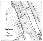
Daytona Florida, 1922
Map of Daytona, Florida in 1922 C.E. Shows local roads around Daytona, Florida. Shows Atlantic Ocean and the Halifax River...

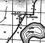
Alamana, 1936
This is a detailed map of the city Alamana in Volusia County, Florida. Section Township Range (STR) is shown. This map shows roads, tenant houses, farm units and dwellings other than farms. Key to Florida Highway maps....

Allendale, 1936
This is a detailed map of the city Allendale in Volusia County, Florida. Section Township Range (STR) is shown. This map shows state roads, businesses, camps, farm units and dwellings other than farms. Key to Florida Hig...

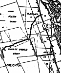
Ariel, 1936
This is a detailed map of the city Ariel in Volusia County, Florida. Section Township Range (STR) is shown. This map shows state roads, US highways, businesses, a church, grants, farm units and dwellings other than farms. Ke...

Benson, 1936
This is a detailed map of the city Benson in Volusia County, Florida. Section Township Range (STR) is shown. This map shows roads, railroads, churches, schools, factories, power plant, post office, camps, farm units and dwellings other than farms.

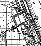
Daytona, 1936
This is a detailed map of the city Daytona in Volusia County, Florida. Section Township Range (STR) is shown. This map shows state roads, US highways, tenant houses, post offices, sawmills, camps, churches, lighthouse, farm units and dwellings other ...

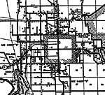
Deland, 1936
This is a detailed map of the city Deland in Volusia County, Florida. Section Township Range (STR) is shown. This map shows state roads, US highways, county seat, railroads, hospital, schools, businesses, a cemetery, churches, tenant houses, sawmills...

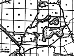
De Leon Springs, 1936
This is a detailed map of the city De Leon Springs in Volusia County, Florida. Section Township Range (STR) is shown. This map shows state roads, tenant houses, a church, a cemetery, recreation area, farm units and dwellings other than farms.

Emporia, 1936
This is a detailed map of the city Emporia in Volusia County, Florida. Section Township Range (STR) is shown. This map shows state roads, US highways, railroads, tenant houses, airport, post office, churches, a cemetery, schools, farm units and dwell...

Glendale, 1936
This is a detailed map of the city Glendale in Volusia County, Florida. Section Township Range (STR) is shown. This map shows state roads, railroads, businesses, camps, churches, a school, a cemetery, farm units and dwellings other than farms.

Lake Helen, 1936
This is a detailed map of the city Lake Helen in Volusia County, Florida. Section Township Range (STR) is shown. This map shows roads, corporate lines, a church, a post office, a business, farm units and dwellings other than farms.

New Smyrna, 1936
This is a detailed map of the city New Smyrna in Volusia County, Florida. Section Township Range (STR) is shown. This map shows state roads, railroads, an airport, farm units and dwellings other than farms. Key to Florid...

Oak Hill, 1936
This is a detailed map of the city Oak Hill in Volusia County, Florida. Section Township Range (STR) is shown. This map shows state roads, US highways, railroads, lighthouse, tenant houses, a factory, a church, businesses, farm units and dwellings ot...

Orange City, 1936
This is a detailed map of the city Orange City in Volusia County, Florida. Section Township Range (STR) is shown. This map shows state roads, US highways, railroads, an airport, sawmill, camps, businesses, farm units and dwellings other than farms. <...

Ormond, 1936
This is a detailed map of the city Ormond in Volusia County, Florida. Section Township Range (STR) is shown. This map shows state roads, US highways, railroads, businesses, a hotel, park, farm units and dwellings other than farms.

Osteen, 1936
This is a detailed map of the city Osteen in Volusia County, Florida. Section Township Range (STR) is shown. This map shows state roads, railroads, post office, businesses, turpentine still, farm units and dwellings other than farms.

Pierson, 1936
This is a detailed map of the city Pierson in Volusia County, Florida. Section Township Range (STR) is shown. This map shows state roads, US highways, railroads, an airport, tenant houses, businesses, churches, a cemetery, a post office, schools, far...

Samsula, 1936
This is a detailed map of the city Samsula in Volusia County, Florida. Section Township Range (STR) is shown. This map shows state roads, tenant houses, businesses, a school, a church, farm units and dwellings other than farms.

Seville, 1936
This is a detailed map of the city Seville in Volusia County, Florida. Section Township Range (STR) is shown. This map shows state roads, US highways, railroads, tenant houses, a church, sawmill, businesses, lighthouse, farm units and dwellings other...

New Smyrna Beach, 1956
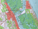
This is a map of New Smyrna Beach in Volusia County, Florida courtesy of the Pennsylvania State University map library. It shows elevation, roads, inland waters and locations of dwellings, a high school, a water tank, a hospital and a radio tower. De...

Ormond Beach to Daytona Beach, 1978
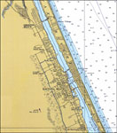
A National Oceanic and Atmospheric Administration map of the area of Florida from Ormond Beach to Daytona Beach current to 1978. This Department of Commerce chart shows all soundings expressed in feet at mean low water. Navigational aids such as ligh...


  FL Maps > Local > Volusia
Site Map  

Maps ETC is a part of the Educational Technology Clearinghouse
Produced by the Florida Center for Instructional Technology © 2007
College of Education , University of South Florida