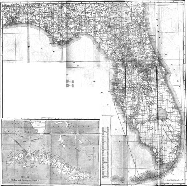
Description: This map of Florida shows railroads and major cities and towns current to 1920. The shore is marked with a shadowed outline of the state. Major waterways are present, though secondary to the railways functions. There is an inset map of Cuba and the Bahama Islands.
Place Names: 1920-1949, Key West, Orlando, Tampa, Cape Canaveral, Saint Augustine, Pensacola, Fort Myers, Fort Lauderdale, Daytona Beach, Gainesville, Jacksonville, Miami, Sarasota, Tallahassee, St Petersburg, West Palm Beach, Naples
ISO Topic Categories: boundaries, transportation, inlandWaters, oceans
Keywords: Florida, physical, political, transportation, swamps, everglades, wetlands, physical features, county borders, railroads, boundaries, transportation, inlandWaters, oceans, Unknown,1920
Source: , (, : US Railroad Administration, 1920)
Map Credit: Courtesy the private collection of Roy Winkelman. |
|