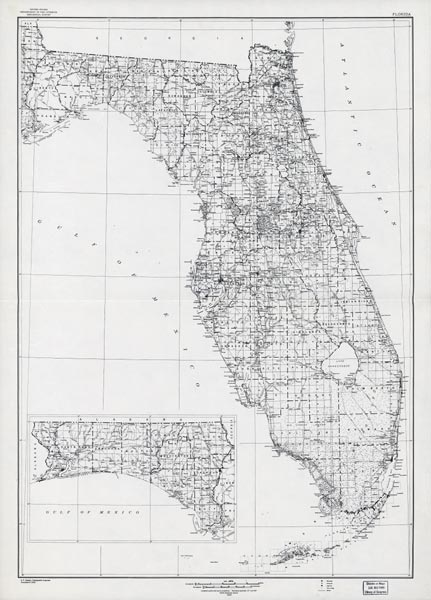
Description: This map of Florida shows railroads and major cities and towns current to 1932. An inset of the panhandle is to the same scale as the rest of the state. Major waterways are shown, as well as lakes, town, islands, and marsh. The Everglades are marked clearly, though not partitioned from the labeling system. Other notable features are Seminole Indian Reservations, canals, and railroads.
Place Names: 1920-1949, Key West, Orlando, Tampa, Cape Canaveral, Saint Augustine, Pensacola, Fort Myers, Fort Lauderdale, Daytona Beach, Gainesville, Jacksonville, Miami, Sarasota, Tallahassee, St Petersburg, West Palm Beach, Naples
ISO Topic Categories: boundaries, transportation, inlandWaters, oceans
Keywords: Florida, physical, political, transportation, swamps, everglades, wetlands, physical features, county borders, railroads, boundaries, transportation, inlandWaters, oceans, Unknown,1932
Source: , (, : US Department of the Interior Geological Survey, 1932)
Map Credit: Courtesy the private collection of Roy Winkelman. |
|