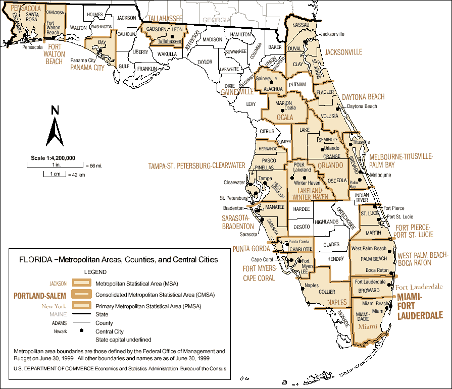
Description: This map shows the metropolitan areas of Florida. The legend indicates Metropolitan Statistical Areas, Consolidated Metropolitan Statistical Areas, Primary Metropolitan Statistical Areas, state lines, county lines, and central city markers. Each of these are reflected on the map. Miami is the largest metropolitan area, according to the map.
Place Names: 1950-1999, Key West, Fort Lauderdale, Miami, Cape Canaveral, Jacksonville, Tampa, St Petersburg, Tallahassee, Panama City, Fort Walton Beach, Daytona Beach, West Palm Beach
ISO Topic Categories: inlandWaters, oceans
Keywords: Florida - Metropolitan Areas, Counties, and Central Cities, physical, swamps, everglades, wetlands, political, physical features, county borders, inlandWaters, oceans, Unknown,1999
Source: US Department of Commerce Economics and Statistics Administration Bureau of the Census, (, : US Department of Commerce Economics and Statistics Administration Bureau of the Census, 1999)
Map Credit: Courtesy the private collection of Roy Winkelman. |
|