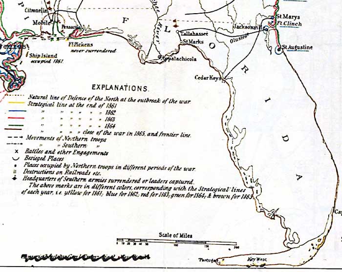
Description: A detail from Sigel's 1889 Historical sketch of the war for the Union showing the lines of demarcation, important movements and battles in each year from 1861 to the close of the war in 1865. The detail shows railroad lines and important Civil War sites in Florida with time references to occupation by Union Forces. Fort Pickens is shown as "never surrendered," St. Marys, Fort Clinch, Jacksonville, and St. Augustine coming under Union control by the end of 1862, and coastal areas around Pensacola Bay and from St. Augustine northward coming under control in 1863 and 1864. The Southern Headquarters in Tallahassee is shown as surrendering at the close of the war in 1865.
Place Names: 1860-1879, Saint Augustine, Tallahassee, Jacksonville, Pensacola, St. Marks, Apalachicola, Ft. Pickens, Olustee, St. Marys, Ft. Clinch, Cedar Keys, Key West, Tortugas
ISO Topic Categories: boundaries, inlandWaters, oceans, society, transportation
Keywords: Detail - Historical sketch of the war for the Union..., physical, political, transportation, historical, physical features, major political subdivisions, railroads, Civil War, boundaries, inlandWaters, oceans, society, transportation, Unknown,1861 to 1865
Source: Franz Sigel, (, : , 1889)
Map Credit: Courtesy of the Geography and Map Division of the Library of Congress |
|