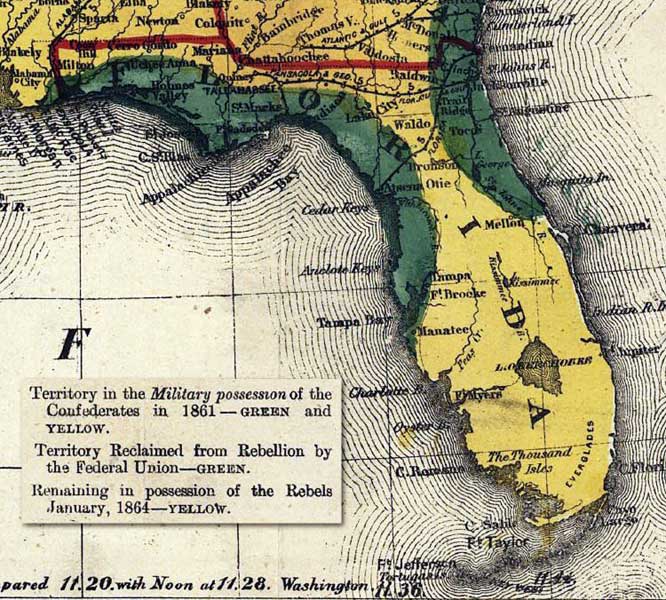
Description: This is a map of Florida showing the territory in possession of the Federal Union, January, 1864. Indicates by color the territories "claimed by the confederates in 1861," "in the military possession of the Confederates in 1861," "reclaimed from rebellion by the Federal Union," and "remaining in possession of the Rebels January, 1864." Map also includes rail lines and gauges, towns, forts, rivers, state boundaries, and distances by rail.
Place Names: 1860-1879, Tallahassee, Tampa, Manatee, Cape Romano, Cape Sable, Ft. Taylor, Cape Canaveral, Kissimmee, Mellon, Ft. Myers, Fort Myers, Ft. Brooke, Lake City, Holmes Valley, Uchee Anna, Milton, Waldo, Bronson, Everglades, Lake Okeechobee, Key Largo, Key West
ISO Topic Categories: boundaries, oceans, inlandWaters
Keywords: Map of Florida, physical, political, historical, Civil War, boundaries, oceans, inlandWaters, Unknown,1864
Source: Bacon and Company, (London, : Bacon and Company, 1864)
Map Credit: Courtesy of the Geography and Map Division of the Library of Congress |
|