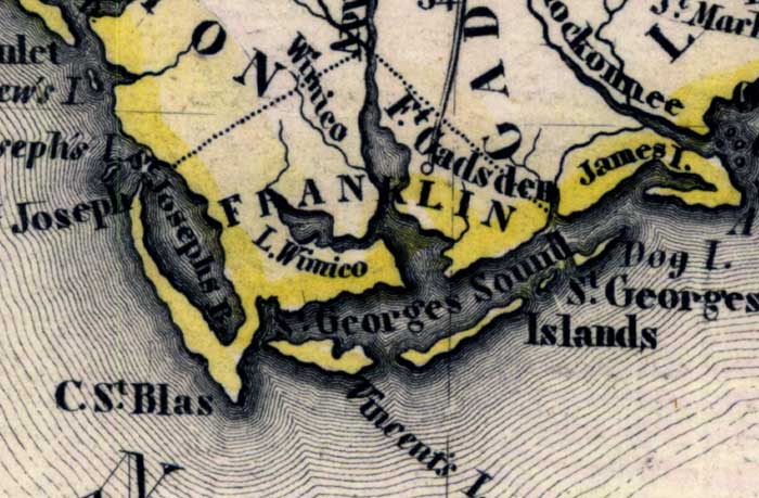
Description: Meyer's 1845 map of Florida is derived from the Tanner/Mitchell Universal atlas map of 1839. This detail of that map covers Franklin County. Routes of travel are covered along with major waterways. One of these for this detail is the Saint George Sound. Islands on the coast are pictured, such as Vincent's Island and James Island.
Place Names: Franklin, Saint Georges Islands, Fort Gadsden, Saint Georges Sound, Saint Josephs River, Cape San Blas, James Island, Dog Island, Lake Wimico, Saint George Sound, Saint Vincent Island
ISO Topic Categories: boundaries, inlandWaters, oceans, society, transportation
Keywords: Franklin County, physical, political, transportation, historical, physical features, major political subdivisions, roads, boundaries, inlandWaters, oceans, society, transportation, Unknown,1845
Source: Joseph Meyer, Grosser Hand-Atlas uber alle Theile der Erde (Hillsburghaus, : Hildburghausen: Bibliographischen Instituts, 1845) 148
Map Credit: Courtesy the private collection of Roy Winkelman |
|