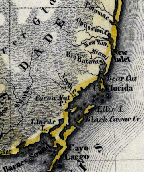
Description: Meyer's 1850 map of Florida is derived from the Tanner/Mitchell Universal atlas map of 1839, and similar to the 1845 maps. In this updated detail of Dade County, waterways and townships are noted. Coastal creeks and rivers are shown such as Rio Ratones, New River, and Sharks River. Other features include Lloyds Lake and Cocoa Nut Point.
Place Names: Dade, New Inlet, Ellis Island, Black Caesar Creek, Cayo Largo, North Creek, Cocoa Nut Point, Lloyds Lake, Rio Ratones, Miami, New River, Opossum Creek, Potomac, Bear Cut, New River Inlet, Barnes Sound, Sharks River, Everglades,
ISO Topic Categories: boundaries, inlandWaters, oceans, society, transportation
Keywords: Dade County, physical, political, transportation, historical, physical features, major political subdivisions, roads, boundaries, inlandWaters, oceans, society, transportation, Unknown,1850
Source: Joseph Meyer, Grosser Hand-Atlas uber alle Theile der Erde (Hillsburghaus, : Hildburghausen: Bibliographischen Instituts, 1850) 148
Map Credit: Courtesy the private collection of Roy Winkelman |
|