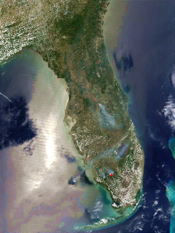
Description: This is a satellite image showing the fires across Florida on May 19, 2001. According to news sources, there were nine large fires burning in Florida on May 19 and as many as fifteen fires burning on May 21.
Place Names: 2000-, Fires
ISO Topic Categories: climatologyMeteorologyAtmosphere, location, inlandWaters, oceans
Keywords: Florida Fires, physical, fires, kfires, ksatellite, physical features, climatologyMeteorologyAtmosphere, location, inlandWaters, oceans, Unknown,May 19, 2001
Source: Jacques Descloitres, (, : MODIS Rapid Response System, 2001)
Map Credit: Courtesy of Jacques Descloitres, MODIS Land Rapid Response Team |
|