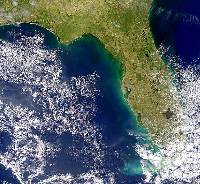
Description: This is a satellite image of Florida from April 10, 2000. Wind is blowing directly westward in this SeaWiFS image, carrying the smoke plume from fires in Florida out over the Gulf of Mexico. The plume appears to be about 150 kilometers long. Another possible plume can be seen in the northern part of the state.
Place Names: 2000-, Fires, Lake Okeechobee
ISO Topic Categories: location, inlandWaters, oceans
Keywords: Smoke Plume from Florida Fires, physical, fires, kfires, ksatellite, physical features, location, inlandWaters, oceans, Unknown,April 10, 2000
Source: NASA Goddard Space Flight Center, (, : NASA Goddard Space Flight Center, 2000)
Map Credit: Courtesy of the SeaWiFS Project, NASA/Goddard Space Flight Center, and ORBIMAGE. |
|