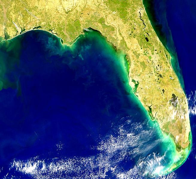
Description: This is a SeaWiFS image of Florida showing red tide conditions along the Gulf Coast of Florida and Louisiana on March 1, 1999.
Place Names: 1950-1999, Lake Okeechobee
ISO Topic Categories: location, inlandWaters, oceans, environment
Keywords: Red Tide Along Florida Panhandle, physical, ksatellite, physical features, location, inlandWaters, oceans, environment, Unknown,March 1, 1999
Source: NASA Goddard Space Flight Center, (, : NASA Goddard Space Flight Center, 1999)
Map Credit: Courtesy of the SeaWiFS Project, NASA/Goddard Space Flight Center, and ORBIMAGE. |
|