Maps Site map
  FL Maps > County > Seminole
Site Map  

Seminole County Maps

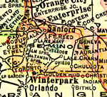
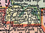
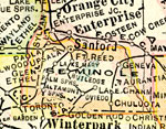
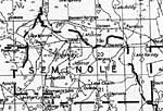
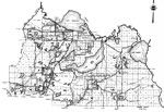
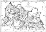
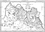
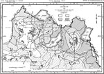
Click on a thumbnail image to view a full size version of that map.

Seminole County is Florida's 50th county, established on April 25, 1913, from a segment of Orange County. It gains its name from the Native Americans who refused to be assimilated into Spanish culture. The term is likely derived from the term cimarrones, and describes animals, plants, and human slaves who refuse domestication. Sanford is the county seat.

For earlier maps of this area, visit the Orange County map gallery.

  Record   1   to   25  of   36

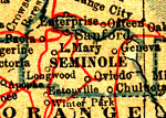
Seminole County, 1914
A map of Seminole County showing county lines, the county seat (Sanford), railroads, and cities current to 1914....

Seminole County, 1916
This map of Seminole County shows the county seat (Sanford), county boundaries, wetlands, railroads, and cities current to 1916....

Seminole County, 1916
This detail of a map of Florida shows county boundaries, roads, cities, towns, villages, lakes, and rivers current to 1916 for Seminole County. This detail has counties and major cities and towns listed in larger font. The counties are also colored f...

Seminole County, 1917
A map of Seminole County showing county lines, the county seat (Sanford), railroads, canals and principal auto routes connecting the major cities current to 1917....

Seminole County, 1917
A map of Seminole County showing county lines, the county seat (Sanford), railroads, and cities current to 1917....

Seminole County, 1920
This detail of a map of Florida shows railroads and major cities and towns current to 1920 for Seminole County. Major waterways are present, though secondary to the railways functions. Featured cities in this detail include Sanford, Chuluota, and Kol...

Seminole County, 1921
A map of Seminole County showing county lines, the county seat (Sanford), and railroads connecting the major cities current to 1921....

Seminole County, 1921
A map of Seminole County showing county lines, the county seat (Sanford), railroads, and cities current to 1921....

Seminole County, 1932
This detail of a map of Florida shows railroads and major cities and towns current to 1932 for Seminole County. Major waterways are shown, as well as lakes, town, islands, and marsh. Other notable features are Seminole Indian Reservations, canals, an...

Seminole, 1936
This is a detailed map of the county of Seminole in the state of Florida. Section Township Range (STR) is shown. This map shows all of the main cities, state roads, US Highways, bridge highways, drawbridge highways, federal aided highway, saw mills, ...

Artesian Flow and Height of the Piezometric Surface, 1954
This map shows areas of artesian flow and the height of the piezometric surface, in feet, referred to land surface in 1954. "Figure 9 shows also contours which represent the height, in feet, referred to land surface, to which water will rise in ...

Dissolved Solids, 1962
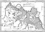
This map shows the dissolved solids content of water from the Floridian aquifer in Seminole County, current to 1962. "The residue of a water, on evaporation, consists of the mineral materials reported in the analyses. A small quantity of organic...

Hardness of Water, 1962
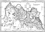
This map shows the hardness of water from the Floridian aquifer in Seminole County, current to 1962. "The hardness of water is most commonly recognized by high soap consumption. It is caused by compounds of calcium and magnesium. These compounds...

Chloride Content and Land Surface Altitude, 1962
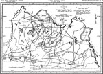
This map shows the relationship of the chloride content of artesian water to the land surface altitude in Seminole County, current to 1962. "Chloride (Cl) is abundant in sea water and is dissolved in small quantities from rocks. The chloride con...

Chloride Content, 1962
This map shows the chloride content of water from the upper part of the Floridian aquifer in Seminole County, current to 1962. "Chloride (Cl) is abundant in sea water and is dissolved in small quantities from rocks. Water from the artesian aquif...

Configuration and Altitudes of the Top Eocene Limestones, 1962
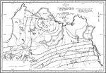
This map shows the configuration and altitude of the top of the Eocene limestones in Seminole County, current to 1962. "The upper part of the Eocene Series in Seminole County consist of the Lake City Limestone, the Avon Park Limestone, and the O...

Configuration and Altitude of the Top of the Avon Park Limestone, 1962
This map shows the configuration and altitude of the top of the Avon Park Limestone in Seminole County, current to 1962. "Structure: Subsurface contours on the top of the Avon Park Limestone are shown in figure 5. This figure shows the top of th...

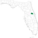
Locater Map of Seminole County, 2008
This is a locater map for Seminole County, 2008. The state is transparent while the county itself is highlighted by color. ...

Clipart Collection: Seminole County Maps in 50 Colors, 2008
A collection of simplified outline maps of Seminole County in your choice of four sizes and fifty colors. These maps are in the GIF format and have very small file sizes so they will download quickly. Use them on your Web pages or in presentations. A...

Plain Frames Collection: Seminole County Maps in 30 Colors, 2008
A collection of transparent frame maps of Seminole County in your choice of thirty colors. Combine these frames with your own photo to create a photo in the shape of the county. Use them on your Web pages or in presentations. ...

Fancy Frames Collection: Seminole County Maps in 30 styles, 2008
A collection of transparent frame maps of Seminole County in your choice of thirty styles including leaves, flowers, shells, hearts, stars, stone, and wood. Combine these frames with your own photo to create a photo in the shape of the map. Use the...

Florida Photo Collection: Seminole County Maps in 30 styles, 2008
A collection of photo maps of Seminole County in your choice of thirty styles including birds, flowers, sunset, dolphins, leaves, hurricane, palms, and water. Use them on your Web pages or in presentations. ...

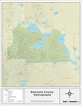
Florida Waterways: Seminole County Outline, 2008
This map was created by FCIT and shows the waterways of Seminole County. All major rivers, streams, creeks, lakes, and swamps are labeled. This map features Wekiva River, Lake Monroe, Little Wekiva River, Gee Creek, Saint Johns River, Lake Harney, La...

Florida Waterways: Seminole County , 2008
This map was created by FCIT and shows the waterways of Seminole County. All major rivers, streams, creeks, lakes, and swamps are labeled. This map features Wekiva River, Lake Monroe, Little Wekiva River, Gee Creek, Saint Johns River, Lake Harney, La...

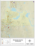
Sinkholes of Seminole County, Florida , 2008
This map was created by FCIT and represents reported sinkhole events in Seminole County based on data gathered by the Florida Geological Survey (FGS) and the Florida Department of Environmental Protection (FDEP). " This dataset represents a set ...

Next Last


  FL Maps > County > Seminole
Site Map  

Maps ETC is a part of the Educational Technology Clearinghouse
Produced by the Florida Center for Instructional Technology © 2007
College of Education , University of South Florida