Maps Site map
  FL Maps > Local > St. Johns
Site Map  

City and Local Maps for St. Johns County

Click on a thumbnail image to view a full size version of that map.

  Record   26   to   43  of   43

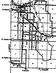
Hastings, 1936
This is a detailed map of the city Hastings in St. Johns County, Florida. Section Township Range (STR) is shown. This map shows state roads, railroads, bituminous roads, corporate lines, churches, businesses, a school, farm units and dwellings other...

Moultrie, 1936
This is a detailed map of the city Moultrie in St. Johns County, Florida. Section Township Range (STR) is shown. This map shows state roads, US highways, railroads, hotels, businesses, churches, a post office, a cemetery, a school, sawmills, farm uni...

Palmo, 1936
This is a detailed map of the city Palmo in St. Johns County, Florida. Section Township Range (STR) is shown. This map shows state roads, bituminous roads, inland water, seasonal dwellings, businesses, sawmill, camps, farm units and dwellings other t...

Palm Valley, 1936
This is a detailed map of the city Palm Valley in St. Johns County, Florida. Section Township Range (STR) is shown. This map shows state roads, bituminous roads, ocean, canal, a business, a school, a church, farm units and dwellings other than farms....

Ponte Vedra Beach, 1936
This is a detailed map of the city Ponte Vedra Beach in St. Johns County, Florida. Section Township Range (STR) is shown. This map shows bituminous roads, water tanks, hotels, a pool, a post office, golf course, farm units and dwellings other than fa...

Sampson Church, 1936
This is a detailed map of the city Sampson Church in St. Johns County, Florida. Section Township Range (STR) is shown. This map shows state roads, railroads, bituminous roads, inland water, graded and drained roads, sawmill, farm units and dwellings ...

Saybrook, 1936
This is a detailed map of the city Saybrook in St. Johns County, Florida. Section Township Range (STR) is shown. This map shows roads, bituminous roads, inland water such as the Matanzas River, railroads, sawmill, turpentine stills, businesses, farm ...

Spuds, 1936
This is a detailed map of the city Spuds in St. Johns County, Florida. Section Township Range (STR) is shown. This map shows state roads, railroads, bituminous roads, other cities such as Armstrong, churches, a school, a post office, farm units and d...

St. Augustine, 1936
This is a detailed map of the city St. Augustine in St. Johns County, Florida. Section Township Range (STR) is shown. This map shows state roads, US highways, railroads, county seat, an airport, schools, businesses, camps, pumping stations, hotels, s...

St. Augustine 2, 1936
This is a detailed map of the city St. Augustine in St. Johns County, Florida. Section Township Range (STR) is shown. This map shows state roads, railroads, county seat, schools, businesses, camps, pumping stations, seasonal dwellings, churches, ceme...

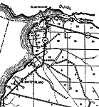
Switzerland, 1936
This is a detailed map of the city Switzerland in St. Johns County, Florida. Section Township Range (STR) is shown. This map shows state roads, inland water, bituminous roads, businesses, a post office, churches, a school, farm units and dwellings ot...

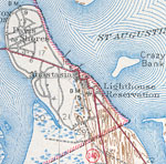
Anastasia, 1943
This is a map of Anastasia in St. Johns County, Florida courtesy of the Pennsylvania State University map library. It shows elevation, roads, lighthouse reservation, inland waters and locations of dwellings. Detail view from a United States Geologica...

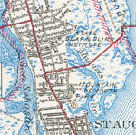
North St. Augustine, 1943
This is a map of North St. Augustine in St. Johns County, Florida courtesy of the Pennsylvania State University map library. It shows elevation, roads, railroads, inland waters and locations of dwellings, churches, schools, State Deaf and Blind Insti...

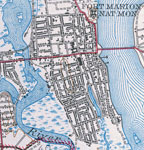
St. Augustine Old Town, 1943
This is a map of St. Augustine Old Town in St. Johns County, Florida courtesy of the Pennsylvania State University map library. It shows elevation, roads, railroads, inland waters and locations of dwellings, churches, schools, Fort Marion National Mo...

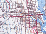
West St. Augustine, 1943
This is a map of west St. Augustine in St. Johns County, Florida courtesy of the Pennsylvania State University map library. It shows elevation, roads, railroads, inland waters and locations of dwellings, cemeteries, churches, a school and more. Detai...

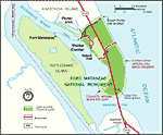
Fort Matanzas National Monument, 1994
A map of the Fort Matanzas National Monument and surrounding areas. The map shows the monument boundaries, the site of Fort Matanzas, areas open or closed to public access, beach ramps, picnic areas, the Intercoastal Waterway, ferry service, and a L...

Fort Mose, 2006
A map showing the location of Fort Mose in relation to St. Augustine. Fort Mose was the first legally sanctioned free black community in present-day U. S. The map also shows the location of the Spanish fort San Marcos, the Indian Village, and the wat...

A View of the town and castle of St. Augustine, and the English camp before it, June 20, 1740
Digitization provided by the USF Libraries Digitization Center. Rare Maps. This is a perspective map of St. Augustine showing an account of the siege of St. Augustine along with a letter from on board the ship Hector, circa 1740. The map is quite det...

First Previous


  FL Maps > Local > St. Johns
Site Map  

Maps ETC is a part of the Educational Technology Clearinghouse
Produced by the Florida Center for Instructional Technology © 2007
College of Education , University of South Florida