|
|
|
| FL Maps > State > 1950-1999 |
|
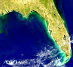
Red Tide Along Florida Panhandle,
March 1, 1999 |
|
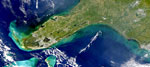
Cape Canaveral Plume,
November 27, 1999 |
|
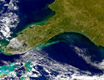
Hurricane Irene After-Effects,
October 18, 1999 |
|
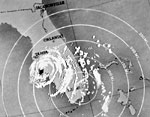
Hurricane Donna,
September 10, 1960 |
|
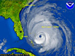
Hurricane Floyd,
September 14, 1999 |
| First | Previous |
| FL Maps > State > 1950-1999 |
Maps ETC
is a part of the
Educational Technology Clearinghouse
Produced by the
Florida Center for Instructional Technology
© 2007
College of Education
,
University of South Florida