Maps Site map
  FL Maps > County > Monroe
Site Map  

Monroe County Maps

Click on a thumbnail image to view a full size version of that map.

Monroe County is Florida's 6th county, established on July 3, 1823, from a segment of St. Johns County. It gains its name from James Monroe (1758-1832), the 5th President of the United States (1817-1825). One of his achievements was obtaining the Floridas from Spain. Key West is the county seat.

For earlier maps of this area, visit the St. Johns County map gallery.


  Record   76   to   90  of   90

Fancy Frames Collection: Monroe County Maps in 30 styles, 2008
A collection of transparent frame maps of Monroe County in your choice of thirty styles including leaves, flowers, shells, hearts, stars, stone, and wood. Combine these frames with your own photo to create a photo in the shape of the map. Use them ...

Florida Photo Collection: Monroe County Maps in 30 styles, 2008
A collection of photo maps of Monroe County in your choice of thirty styles including birds, flowers, sunset, dolphins, leaves, hurricane, palms, and water. Use them on your Web pages or in presentations. ...

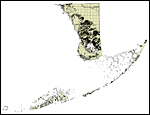
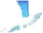
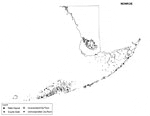
Florida Waterways: Monroe County Outline, 2008
This map was created by FCIT and shows the waterways of Monroe County. All major rivers, streams, creeks, lakes, and swamps are labeled. This map features New River, Alligator Bay, Big Lostmans Bay, Rodgers River Bay, Rodgers River, Wood River, Broad...

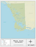
Florida Waterways: Monroe County , 2008
This map was created by FCIT and shows the waterways of Monroe County. All major rivers, streams, creeks, lakes, and swamps are labeled. This map features New River, Alligator Bay, Big Lostmans Bay, Rodgers River Bay, Rodgers River, Wood River, Broad...

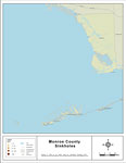
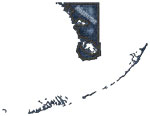
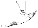
Sinkholes of Monroe County, Florida , 2008
This map was created by FCIT and represents reported sinkhole events in Monroe County based on data gathered by the Florida Geological Survey (FGS) and the Florida Department of Environmental Protection (FDEP). " This dataset represents a set of...

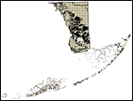
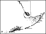
Florida Waterways: Monroe County Outline without Labels, 2008
This topographical map was created by FCIT and shows the waterways of Monroe County. All major rivers, streams, creeks, canals, bays and lakes are present, but not labeled. For a student activity sheet with directions for labeling the following: Chat...

Monroe "Abstract" Style Maps in 30 Styles, 2008
A collection of 30 Monroe County maps in a range of abstract graphic styles suitable for use in presentations and websites. Since the style is abstract, these maps can be used in projects on a wide variety of topics. Each of the maps is in the JPEG f...

Monroe County "Fun" Maps in 30 Styles, 2008
A collection of 30 Monroe County maps in a crazy range of styles including blue jeans, chalkboards, pirate maps, coins, hearts, and even swimming pools. Use them as attention-getting slides in presentations or on websites. Each of the maps is in the...

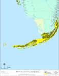
Florida Seagrass: Monroe, 2008
This topographical map was created by FCIT and shows the seagrass distribution for Monroe County. The green coloration depicts continuous seagrass while the yellow shows discontinuous seagrass. In addition to the seagrass, rivers, towns, and highway...

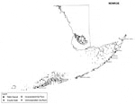
Monroe County Cities with Labels, 2009
This is a black and white city map of Monroe county, 2009. It shows the location with names of unincorporated cities/towns (black dot) such as Flamingo, incorporated cities/towns (circle with dot) such as Layton, and the county seat (circle with star...

Monroe County Cities Outline, 2009
This is a black and white city outline map of Monroe county, 2009. It shows the location without names of unincorporated cities/towns (black dot), incorporated cities/towns (circle with dot), and the county seat (circle with star)....

Monroe County Road Network- Black and White, 2009
This is a black and white road map of Monroe county, 2009. It shows the location of many roads, including US-1/Overseas Hwy and Flamingo Lodge Hwy. ...

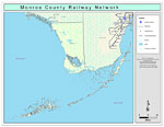
Monroe County Railway Network- Black and White, 2009
This is a black and white railroad map of Monroe county, 2009. It also shows location of cities and towns including Key West and Key Largo....

Monroe County Railway Network- Color, 2009
This is a color map of Monroe county, 2009. It also shows location of cities and towns including Key West and Key Largo, inland water including rivers and lakes, and Amtrak stations....

Monroe County Road Network- Color, 2009
This is a color road map of Monroe county, 2009. It shows the location of many roads including US-1, cities and towns, and inland water....

First Previous


  FL Maps > County > Monroe
Site Map  

Maps ETC is a part of the Educational Technology Clearinghouse
Produced by the Florida Center for Instructional Technology © 2007
College of Education , University of South Florida