Maps Site map
  FL Maps > Local > Monroe
Site Map  

City and Local Maps for Monroe County

Click on a thumbnail image to view a full size version of that map.

  Record   126   to   150  of   156

Ramrod Key, 1975
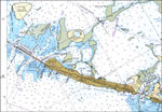
A National Oceanic and Atmospheric Administration map of Ramrod Key including Summerland Key and Middle Torch Key, Florida, current to 1975. This Survey chart shows all soundings and heights expressed in feet. Obstructions such as shoals, submerged p...

Sugarloaf Key and Cudjoe Key, 1975
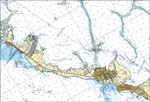
A National Oceanic and Atmospheric Administration map of Sugarloaf Key and Cudjoe Key including, Florida, current to 1975. This Survey chart shows all soundings and heights expressed in feet. Obstructions such as shoals, submerged piles, fixed bridge...

Long Key, 1975
A National Oceanic and Atmospheric Administration map north of Long Key, Florida current to1975. This Survey chart shows all soundings expressed in feet. Navigational aids such as lights, beacons and buoys are shown as well as obstructions such as sh...

Grassy Key and Duck Key, 1975
A National Oceanic and Atmospheric Administration map of Duck Key and Grassy Key, Florida current to1975. This Survey chart shows all soundings expressed in feet. Navigational aids such as lights, beacons and buoys are shown as well as obstructions s...

Matecumbe Keys, 1975
A National Oceanic and Atmospheric Administration map of Matecumbe Keys, Florida current to1975. This Department of Commerce chart shows all soundings expressed in feet at mean lower low water. Navigational aids such as lights, beacons and buoys are ...

Elliott Key to Tarpon Basin, 1976
A National Oceanic and Atmospheric Administration map of the area of Elliott Key to Tarpon Basin, Florida current to1976. This Department of Commerce chart shows all soundings expressed in feet at mean lower low water. Navigational aids such as light...

Key West Harbor, 1977
A National Oceanic and Atmospheric Administration map of Key West Harbor current to1977. This Survey chart shows all soundings and heights expressed in feet. Navigational aids such as lights, beacons, buoys and measures of magnetic declination varian...

Grassy Key to Bahia Honda Key, 1977
A National Oceanic and Atmospheric Administration map north of the area between Bahia Honda Key and Grassy Key current to1977. This Survey chart shows all soundings and heights expressed in feet. Navigational aids such as lights, beacons, buoys and m...

East Cape to Mormon Key, 1977
A National Oceanic and Atmospheric Administration map of Gulf Coast, from East Cape to Mormon Key, current to 1977. This Department of Commerce chart shows all soundings expressed in feet at Gulf Coast low water Datum. Navigational aids such as light...

Lostmans River, 1977
A National Oceanic and Atmospheric Administration map of Lostmans River current to 1977. This Department of Commerce chart shows all soundings expressed in feet at Gulf Coast low water Datum. Navigational aids such as lights are shown as well as obst...

Bahia Honda Key, 1977
A National Oceanic and Atmospheric Administration map of Bahia Honda Key 1975. This Survey chart shows all soundings and heights expressed in feet. Navigational aids such as lights, beacons and buoys are shown as well as obstructions such as shoals, ...

Vaca Key, 1977
A National Oceanic and Atmospheric Administration map of Vaca Key, Florida current to1977. This Survey chart shows all soundings and heights expressed in feet. Navigational aids such as lights, beacons and buoys are shown as well as obstructions suc...

Fat Deer Key, 1977
A National Oceanic and Atmospheric Administration map of Fat Deer Key, Florida current to1977. This Survey chart shows all soundings and heights expressed in feet. Obstructions to navigation such as shoals, submerged piles, wreckage, fixed bridges, a...

Florida Keys, Alligator Reef to Sombrero Key, 1978
A National Oceanic and Atmospheric Administration map of the Florida Keys between Alligator Reef to Sombrero Key current to1978. This Survey chart shows all soundings expressed in feet. Navigational aids such as lights, beacons, buoys and measures of...

Lower Florida Keys, 1978
A National Oceanic and Atmospheric Administration map of Lower Florida Keys, current to 1978. This Department of Commerce chart shows all soundings expressed in fathoms at Gulf Coast low water datum. Navigational aids such as lights, beacons and buoy...

Big Spanish Channel to Johnston Key, 1979
A National Oceanic and Atmospheric Administration map north of the area between Bahia Honda Key and Sugarloaf Key current to1979. This Survey chart shows all soundings and heights expressed in feet. Navigational aids such as lights, beacons, buoys an...

Key West, 1989
A US Geological Survey and National Ocean Service map of the Florida Keys current to 1989. This topographic-bathymetric map shows elevations and depths in meters. Bathymetric contour interval 10 meters. 1989 magnetic declination from true north var...

Key West to Big Pine Key, 1989
A US Geological Survey and National Ocean Service map of the Florida Keys current to 1989. This topographic-bathymetric map shows elevations and depths in meters. Bathymetric contour interval 10 meters. Map also includes roads, waterways, airports,...

Blackwater Sound to Matecumbe, 1992
A National Oceanic and Atmospheric Administration map of the area of Blackwater Sound to Matecumbe, Florida current to1992. This Department of Commerce chart shows all soundings expressed in feet at mean lower low water. Navigational aids such as lig...

Key Largo, 1992
A National Oceanic and Atmospheric Administration map of Key Largo, Florida current to1992. This Department of Commerce chart shows all soundings expressed in feet at mean lower low water. Navigational aids such as lights, beacons and buoys are shown...

Upper Matecumbe Key, 1992
A National Oceanic and Atmospheric Administration map of Upper Matecumbe Key, Florida current to1992. This Department of Commerce chart shows all soundings expressed in feet at mean lower low water. Navigational aids such as lights, beacons and buoys...

Plantation Key, 1992
A National Oceanic and Atmospheric Administration map of Plantation Key, Florida current to1992. This Department of Commerce chart shows all soundings expressed in feet at mean lower low water. Navigational aids such as lights, beacons and buoys are ...

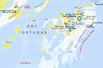
Dry Tortugas National Park, 1994
A map of the Dry Tortugas National Park showing the Tortugas island group, Fort Jefferson, and locations for fishing, scuba diving, snorkeling, and boat anchorage. ...

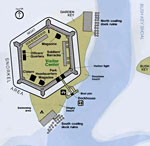
Detail of Fort Jefferson, Dry Tortugas National Park, 1994
A detail map of Fort Jefferson in the Dry Tortugas National Park. The map shows the Park Visitor Center within the fort, various historical structures within the fort, and campsites, swimming and snorkeling areas, boat pier, and seaplane beach....

Detail - Everglades National Park, 1994
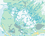
This detail of a map of the Everglades National Park is a color-coded map of the various Everglades Ecosystems. The portion of the largest green spreading along the coast is coastal marsh. The orange lines are coastal prairie. The brightest green, in...

First Previous Next Last


  FL Maps > Local > Monroe
Site Map  

Maps ETC is a part of the Educational Technology Clearinghouse
Produced by the Florida Center for Instructional Technology © 2007
College of Education , University of South Florida