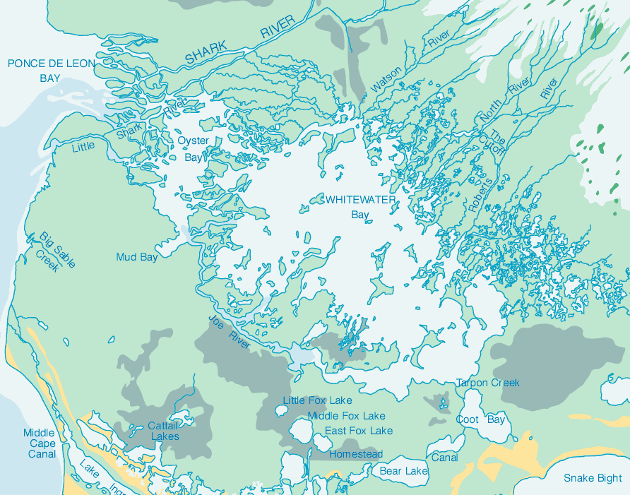
Description: This detail of a map of the Everglades National Park is a color-coded map of the various Everglades Ecosystems. The portion of the largest green spreading along the coast is coastal marsh. The orange lines are coastal prairie. The brightest green, in the middle right, is pineland. The speckles of dark teal are hardwood hammock. The rest of the key can be found on the Nation Park Service website. Whitewater Bay is the central waterway, surrounded by smaller lakes, rivers, and bays.
Place Names: Monroe, Everglades, Whitewater Bay, Snake Bight, Shark River, Ponce De Leon Bay, Middle Cape Canal,
ISO Topic Categories: inlandWaters, oceans
Keywords: Detail - Everglades National Park, physical, swamps, everglades, wetlands, physical features, inlandWaters, oceans, Unknown,1994
Source: , (, : National Park Service, 1994)
Map Credit: Courtesy the private collection of Roy Winkelman. |
|