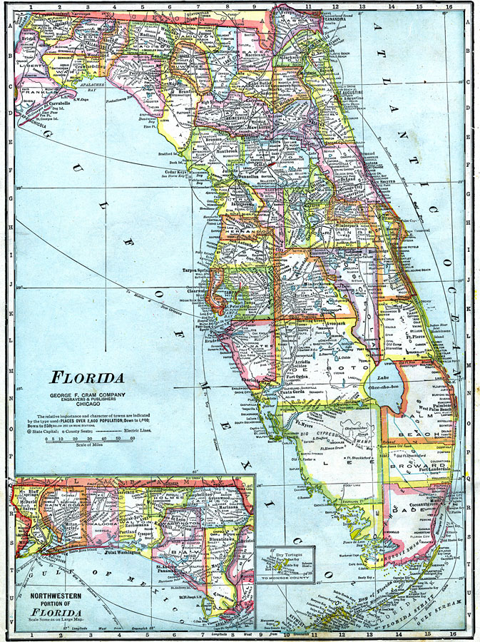
Description: A map of Florida showing county lines current to 1921, including each county seat, major cities, and railroad stations. The railroad system extends as far south as Fort Myers on the Gulf Coast, Sebring in central Florida, and along the Atlantic Coast from Daytona to Miami and across the Florida Keys to Key West. Major shipping routes are shown with port-to-port names. Major rivers and wetlands are shown as well as the canal system developed to drain the Everglades. The historical sites for several early forts are shown as well as J. E. Ingraham's 1892 route across the Everglades from Fort Myers to Miami. Longitude is shown as west from Greenwich. The western panhandle (approximately west of the Apalachicola River) and a detail of the Dry Tortugas are shown on inset maps.
Source: George F. Cram, (Chicago, IL: George F. Cram Company, 1921) 46
Map Credit: Courtesy the private collection of Roy Winkelman |
|