mapsExploring Florida
 FL Maps > State > 1900-1919 > South Florida, 1917
Site Map 

South Florida, 1917


Puzzle Directions: Click on a puzzle piece and drag it where you want it. When you connect two pieces correctly, they will join together. Mix up the pieces again. View finished map in pop-up window.

Title: South Florida
Projection: Unknown
Source Bounding Coordinates:
W: -85.5 E: -80 N: 27.75 S: 24

Back to Map Page
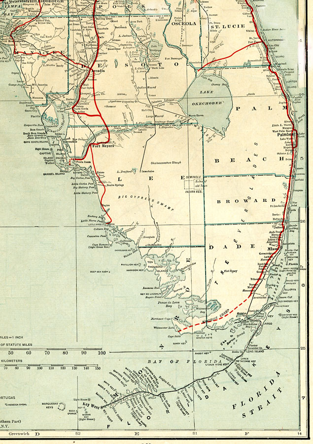
Description: This is a 1917 map of the Southern portion of FL, with an inset of the panhandle available in the lower left corner. It gives detail about transportation routes including canals, railroads, and roads. County boundaries and County seats current to the year 1917.
Source: C.O. Sylvester Mawson, Geographic Manual and New Atlas (Garden City, NY: Doubleday, Page & Company, 1917) 168 - 169
Map Credit: Courtesy the private collection of Roy Winkelman.
SearchLicensePDF HelpGIS Help Google Earth Help Zoomify Help

 FL Maps > State > 1900-1919 > South Florida, 1917