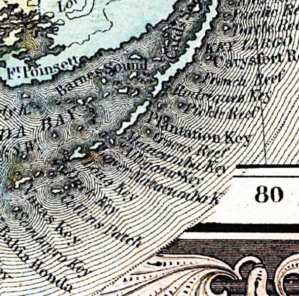
Description: This detail of the upper keys of Manatee County is current to 1860. This map shows drainage, state and county boundaries, place names, steamboat routes, and the railroad network. Each county is colored pastel for ease of differentiation. The main feature of this detail is Barnes Sound.
Place Names: Monroe, Barnes Sound, Plantation Key, Key Largo, French Reef, Matacombe Key, Long Key, Collins Beach, Vacas, Bahia Honda,
ISO Topic Categories: transportation, inlandWaters, location, oceans
Keywords: Monroe County - Upper Keys, political, county borders, transportation, inlandWaters, location, oceans, Unknown,1860
Source: , (, : , 1860)
Map Credit: Courtesy of the private collection of Roy Winkelman. |
|