Maps Site map
  FL Maps > Local > Monroe
Site Map  

City and Local Maps for Monroe County

Click on a thumbnail image to view a full size version of that map.

  Record   1   to   25  of   156

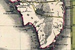
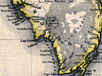
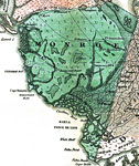
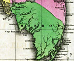
Detail - Geographical, statistical, and historical map of Florida, 1827
This detail of a 1827 map shows major rivers, lakes, coastal features, settlements, and roads in the Mainland of Monroe County. The county is crossed by many waterways including the Caloosahatchee River, the Youngs River, and Gallivans Creek. The coa...

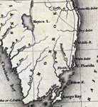
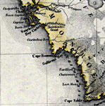
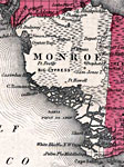
Detail - Geographical, statistical, and historical map of Florida, 1827
This detail of a 1827 map shows major rivers, lakes, coastal features, settlements, and roads in the Upper Keys of Monroe County. The county is crossed by many waterways including the Sharks River and North Creek. The coast line features the Florida ...

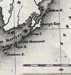
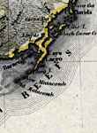
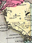
Detail - Geographical, statistical, and historical map of Florida, 1827
This detail of a 1827 map shows major rivers, lakes, coastal features, settlements, and roads in the Lower Keys of Monroe County. In addition to the Florida Reefs, many keys are indicated, such as Sand Key, Cayas Vacas, Pine Key, New Castle Island, K...

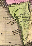
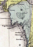
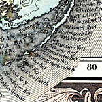
Monroe County- Mainland, 1830
Digitization provided by the USF Libraries Digitization Center. Rare Maps. This is a map of the Monroe County Mainland, circa 1830. It is a portion of Rand McNally and Co.'s new business map of Florida. It shows county boundaries, cities and towns, a...

Monroe County- Florida Keys, 1830
Digitization provided by the USF Libraries Digitization Center. Rare Maps. This is a map of the Florida Keys in Monroe County, circa 1830. It is a portion of Rand McNally and Co.'s new business map of Florida. It shows county boundaries, islands and ...

Monroe County- Mainland, 1832
Digitization provided by the USF Libraries Digitization Center. Rare Maps. This is a map of the Monroe County mainland, circa 1832. It shows county boundaries, cities and towns and inland waters. Lake Okeechobee is shown as Mayaca Lake. Scale [ca. 1:...

Monroe County- Upper Keys, 1832
Digitization provided by the USF Libraries Digitization Center. Rare Maps. This is a map of the Upper Keys in Monroe County, circa 1832. It shows cities, towns and inland waters. Scale [ca. 1:4,181,760]...

Monroe County- Lower Keys, 1832
Digitization provided by the USF Libraries Digitization Center. Rare Maps. This is a map of the Lower Keys in Monroe County, circa 1832. It shows all of the lower keys including Key West which is shown as Thompsons Island. Also, Big Pine is shown as ...

Detail - Map of the State of Florida, 1842
This detail of a 1842 map of Florida shows roads, railroads, counties, forts, naval depots and other military installations, major towns, rivers, and lakes for the mainland of Monroe County. Several waterways traverse Monroe County including Delaware...

Detail - Map of the State of Florida, 1842
This detail of a 1842 map of Florida shows roads, railroads, counties, forts, naval depots and other military installations, major towns, rivers, and lakes for the Keys of Monroe County. Several keys are labeled as well as the Tortugas Bank and Cape ...

Monroe County - Mainland, 1845
Meyer's 1845 map of Florida is derived from the Tanner/Mitchell Universal atlas map of 1839. This detail of that map covers the mainland of Monroe County. Routes of travel are covered along with major waterways. The Everglades expand over the majorit...

Monroe County - Upper Keys, 1845
Meyer's 1845 map of Florida is derived from the Tanner/Mitchell Universal atlas map of 1839. This detail of that map covers the upper keys of Monroe County. Routes of travel are covered along with major waterways. The Everglades expand over the major...

Monroe County - Lower Keys, 1845
Meyer's 1845 map of Florida is derived from the Tanner/Mitchell Universal atlas map of 1839. This detail of that map covers the lower keys of Monroe County. Routes of travel are covered along with major waterways. The tip of the Florida mainland, Cap...

Monroe County- Mainland, 1850
Meyer's 1850 map of Florida is derived from the Tanner/Mitchell Universal atlas map of 1839, and similar to the 1845 maps. In this updated detail of the mainland of Monroe County, waterways and townships are noted. Coastal features shown include Char...

Monroe County- Upper Keys, 1850
Meyer's 1850 map of Florida is derived from the Tanner/Mitchell Universal atlas map of 1839, and similar to the 1845 maps. In this updated detail of the upper keys of Monroe County, waterways and townships are noted. Coastal features shown include Ca...

Monroe County- Lower Keys, 1850
Meyer's 1850 map of Florida is derived from the Tanner/Mitchell Universal atlas map of 1839, and similar to the 1845 maps. In this updated detail of the lower keys of Monroe County, waterways and townships are noted. The tip of Cape Sable is visible....

Monroe County - Mainland, 1850
This detail of a 1850 map from the New Universal Atlas shows towns, forts, roads, canals, major rivers and lakes in the mainland of Monroe County. The map is very similar to the 1839 map from Tanner's Universal Atlas. There are references to forts, ...

Monroe County - Keys, 1850
This detail of a 1850 map from the New Universal Atlas shows the keys of Monroe County. The map is very similar to the 1839 map from Tanner's Universal Atlas. There are references to forts, battlefields, and routes used by the Army during the Semino...

Monroe County - Mainland, 1856
This detail of a map from the annual report of the Surveyor General in 1856 shows Monroe County. Drainage, cities and towns, roads, trails, and location of railroad lines are shown in great detail. The major feature of detail is the Everglades. Other...

Monroe County - Keys, 1856
This detail of a map from the annual report of the Surveyor General in 1856 shows Monroe County. Drainage, cities and towns, roads, trails, and location of railroad lines are shown in great detail. The major feature of detail is the Florida Keys. Of ...

Plan of the Florida Keys, 1860
This is a map of the Florida Keys. It shows keys and islands such as Key West, towns or villages such as Cape Sable, oceans such as the Gulf of Mexico, and inland waters such as White Water Bay....

Monroe Mainland, 1860
This is a map of Monroe County mainland, current to 1860. It shows cities and towns, inland water such as the Ponce de Leon Bay, and more....

Monroe County - Mainland, 1860
This detail of the mainland of Manatee County is current to 1860. This map shows drainage, state and county boundaries, place names, steamboat routes, and the railroad network. Each county is colored pastel for ease of differentiation. The main featu...

Monroe County - Upper Keys, 1860
This detail of the upper keys of Manatee County is current to 1860. This map shows drainage, state and county boundaries, place names, steamboat routes, and the railroad network. Each county is colored pastel for ease of differentiation. The main fea...

Monroe County - Lower Keys, 1860
This detail of the lower keys of Manatee County is current to 1860. This map shows drainage, state and county boundaries, place names, steamboat routes, and the railroad network. Each county is colored pastel for ease of differentiation. The main fea...

Next Last


  FL Maps > Local > Monroe
Site Map  

Maps ETC is a part of the Educational Technology Clearinghouse
Produced by the Florida Center for Instructional Technology © 2007
College of Education , University of South Florida