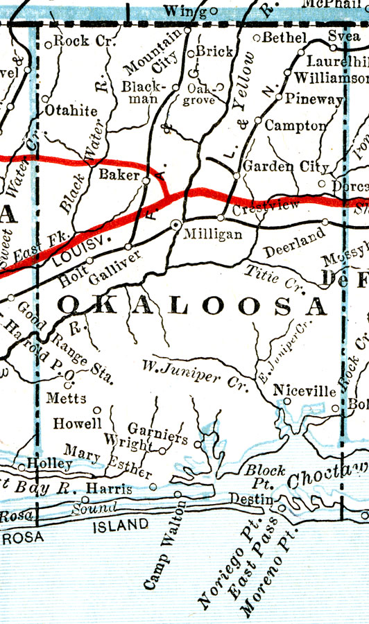
Description: A map of Okaloosa County showing county lines, the county seat (Milligan), railroads, canals, and principal auto routes connecting the major cities current to 1917. The current county seat of Okaloosa County is Crestview.
Place Names: Okaloosa, Garniers, Mary Esther, Niceville, Bethel, Crestview, Destin, Laurel Hill
ISO Topic Categories: boundaries, inlandWaters, transportation
Keywords: Okaloosa County, physical, political, transportation, physical features, county borders, roads, railroads, boundaries, inlandWaters, transportation, Unknown,1917
Source: C.O. Sylvester Mawson, Geographic Manual and New Atlas (Garden City, NY: Doubleday, Page & Company, 1917) 168
Map Credit: Courtesy the private collection of Roy Winkelman. |
|