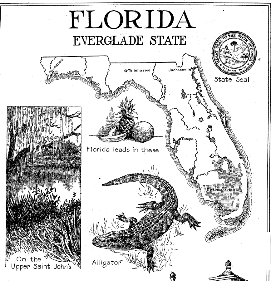
Description: A sketch-map of Florida relating the coastline, rivers and major inland waters, the Everglades, and only the cities of Pensacola, Tallahassee, Jacksonville and Tampa. The 1921 State Seal has errors (corrected in 1985) including a Western Plains Indian rather than a Florida Seminole, and a cocoa palm instead of the native sabal palm. The map illustrations also include the State Flower (Orange Blossom), leading agricultural products (oranges, pineapples, bananas, and cotton), a prominent historical site (Old Spanish Gate, St. Augustine), an illustration of the upper St. JohnŐs River, and an illustration of an American Alligator.
Source: Ellsworth D. Foster, The American Educator (Chicago, IL: Ralph Durham Company, 1921) 1351
Map Credit: Courtesy the private collection of Roy Winkelman |
|